Near Atlanta in Montmorency County, Michigan — The American Midwest (Great Lakes)
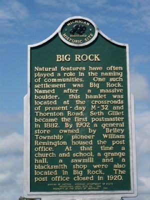
Big Rock
Erected 1991 by Bureau of History, Michigan Department of State. (Marker Number L1808.)
Topics and series. This historical marker is listed in these topic lists: Natural Features • Settlements & Settlers. In addition, it is included in the Michigan Historical Commission, and the Postal Mail and Philately series lists. A significant historical year for this entry is 1882.
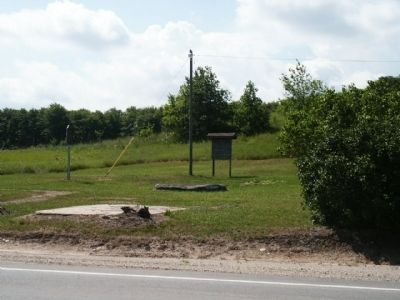
Location. 45° 0.42′ N, 84° 14.051′ W. Marker is near Atlanta, Michigan, in Montmorency County. Marker is at the intersection of State Highway 32 and Beltz Road, on the left when traveling west on State Highway 32. Beltz Road is called Thornton Road north of M-32. Big Rock is approximately 4.6 miles west of Atlanta. Touch for map. Marker is in this post office area: Atlanta MI 49709, United States of America. Touch for directions.
Other nearby markers. At least 3 other markers are within 9 miles of this marker, measured as the crow flies. Angusdale Stock Farm (approx. 5.1 miles away); Camp Lunden (approx. 8.9 miles away); Congregational United Church of Christ (approx. 9 miles away).

Photographed By Joel S., July 7, 2010
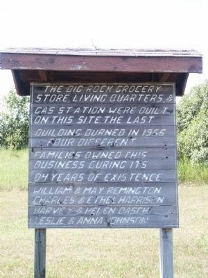
2. The Big Rock Grocery Store, Living Quarters, & Gas Station sign
The Big Rock Grocery store, living quarters, & gas station were built on this site. The last building burned in 1966. Four different families owned this business during its 84 years of existence.
William & May Remington
Charles & Ethel Harrison
Harvey & Helen Basch
Leslie & Anna Johnson
William & May Remington
Charles & Ethel Harrison
Harvey & Helen Basch
Leslie & Anna Johnson
Credits. This page was last revised on June 16, 2016. It was originally submitted on July 19, 2010, by Joel Seewald of Madison Heights, Michigan. This page has been viewed 1,568 times since then and 61 times this year. Photos: 1, 2, 3. submitted on July 19, 2010, by Joel Seewald of Madison Heights, Michigan. • Bill Pfingsten was the editor who published this page.

