Near Trappe in Talbot County, Maryland — The American Northeast (Mid-Atlantic)
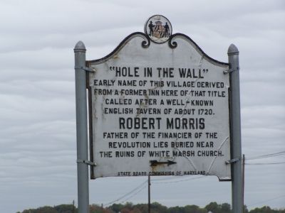
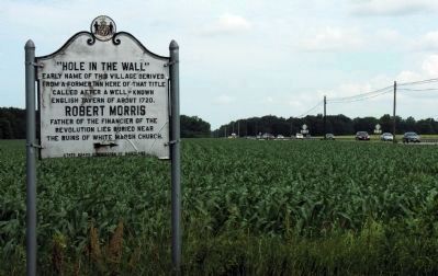
“Hole-in-the-Wall”
Erected by State Roads Commission.
Topics. This historical marker is listed in these topic lists: Cemeteries & Burial Sites • Colonial Era • Settlements & Settlers • War, US Revolutionary. A significant historical year for this entry is 1720.
Location. 38° 41.764′ N, 76° 3.685′ W. Marker is near Trappe, Maryland, in Talbot County. Marker is at the intersection of U.S. 50 and Almshouse Road, on the right when traveling south on U.S. 50. Touch for map. Marker is in this post office area: Trappe MD 21673, United States of America. Touch for directions.
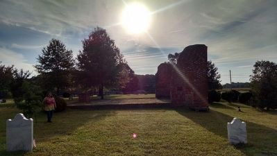
Other nearby markers. At least 8 other markers are within 3 miles of this marker, measured as the crow flies. Old White Marsh Episcopal Church (about 300 feet away, measured in a direct line); Robert Morris, Sr. (about 600 feet away); Home Run Baker Park (approx. 2.2 miles away); Peachblossom Meetinghouse (approx. 2.6 miles away); Site of Trappe High School (approx. 2.7 miles away); Old Wintersell Schoolhouse (approx. 3 miles away); Nathaniel Hopkins (approx. 3 miles away); Nathaniel (Nace) Hopkins (approx. 3.1 miles away). Touch for a list and map of all markers in Trappe.
More about this marker. See Old White Marsh Episcopal Church marker and Robert Morris marker.
Also see . . . Robert Morris's Grave. at White Marsh Cemetery at Find-a-Grave. (Submitted on February 17, 2013, by Allen C. Browne of Silver Spring, Maryland.)
Credits. This page was last revised on November 22, 2019. It was originally submitted on November 5, 2007, by Bill Pfingsten of Bel Air, Maryland. This page has been viewed 3,670 times since then and 103 times this year. Photos: 1. submitted on November 5, 2007, by Bill Pfingsten of Bel Air, Maryland. 2. submitted on August 23, 2015, by Jacqueline White of Williamsburg, VA - Virginia. 3. submitted on February 17, 2013, by Allen C. Browne of Silver Spring, Maryland.


