Trappe in Talbot County, Maryland — The American Northeast (Mid-Atlantic)
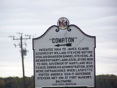
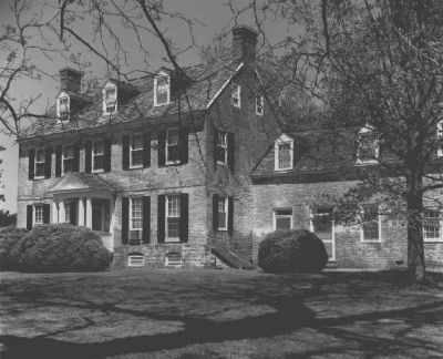
“Compton”
←
Erected by State Roads Commission.
Topics. This historical marker is listed in these topic lists: Churches & Religion • Civil Rights • Colonial Era • Forts and Castles • Settlements & Settlers. A significant historical year for this entry is 1664.
Location. 38° 39.096′ N, 76° 3.435′ W. Marker is in Trappe, Maryland, in Talbot County. Marker is at the intersection of U.S. 50 and Howell Point Road, on the right when traveling south on U.S. 50. Touch for map. Marker is in this post office area: Trappe MD 21673, United States of America. Touch for directions.
Other nearby markers. At least 8 other markers are within 4 miles of this marker, measured as the crow flies. Nathaniel (Nace) Hopkins (within shouting distance of this marker); Nathaniel Hopkins (within shouting distance of this marker); Site of Trappe High School (approx. 0.4 miles away); Home Run Baker Park (approx. 0.9 miles away); “Hole-in-the-Wall” (approx. 3.1 miles away); Old White Marsh Episcopal Church (approx. 3.1 miles away); Robert Morris, Sr. (approx. 3.1 miles away); “The Wilderness” (approx. 4 miles away). Touch for a list and map of all markers in Trappe.
Credits. This page was last revised on November 22, 2019. It was originally submitted on November 5, 2007, by Bill Pfingsten of Bel Air, Maryland. This page has been viewed 1,673 times since then and 32 times this year. Photos: 1. submitted on November 5, 2007, by Bill Pfingsten of Bel Air, Maryland. 2. submitted on March 3, 2008, by Christopher Busta-Peck of Shaker Heights, Ohio.

