Fernandina Beach in Nassau County, Florida — The American South (South Atlantic)
McClure's Hill
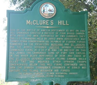
Photographed by Dale K. Benington, June 25, 2010
1. McClure's Hill Marker
Erected by The General Duncan L. Clinch Historical Society of Amelia Island, Florida.
Topics. This historical marker is listed in these topic lists: Colonial Era • Military. A significant historical date for this entry is September 13, 1855.
Location. 30° 40.93′ N, 81° 26.966′ W. Marker is in Fernandina Beach, Florida, in Nassau County. It is on North 14th Street
this page online

Regionally, this marker is in First Coast, in Greater Jacksonville, and on the Sea Islands. It is also in the American South and on the Eastern Seaboard. Globally, it is in the North Atlantic Region, North America, a Gulf of Mexico state, the Western Hemisphere, the Western World, and the Anglosphere. Historically, it finds itself in what was once New Spain, the territory of the Mississippian Culture, one of the Confederate States of America, and the Antebellum South.
Other nearby markers. At least 8 other markers are within walking distance of this marker: Old Town (approx. half a mile away); Plaza San Carlos (approx. 0.6 miles away); Fort San Carlos (approx. 0.6 miles away); The UNESCO Slave Route Project: Resistance, Liberty, Heritage / Amelia Island, Fl (approx. 0.6 miles away); 6-Pound Cannon (approx. 0.6 miles away); Shipwreck, Slavery and Survival (approx. 0.6 miles away); Fort Clinch Military Road (approx. 0.6 miles away); The Plaza (approx. 0.6 miles away). Touch for a list and map
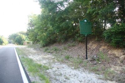
Photographed by Dale K. Benington, June 25, 2010
2. McClure's Hill Marker
View looking north along North 14th Street with both the historical marker and McClure's Hill seen on the right side of the picture.
Credits. This page was last revised on February 10, 2018. It was originally submitted on July 20, 2010, by Dale K. Benington of Toledo, Ohio. This page has been viewed 2,346 times since then and 110 times this year. Photos: 1, 2. submitted on July 20, 2010, by Dale K. Benington of Toledo, Ohio.
