Near Smyrna in Cobb County, Georgia — The American South (South Atlantic)
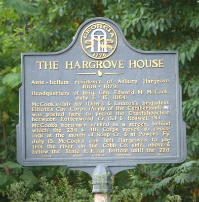
The Hargrove House
Headquarters of Brig. Gen. Edward M. McCook, July 6 ~ 15, 1864.
McCook’s (1st) div. (Dorr’s & Lamson’s brigades), Elliott’s Cav. Corps (Army of the Cumberland) [US], was posted here to patrol the Chattahoochee between Rottenwood Cr. (S.) & Roswell (N.).
McCook’s horsemen served as a screen, behind which the 23d & 4th Corps moved to crossings at the mouth of Soap Cr. & at Power’s Fy.
July 15. McCook’s cav. left Hargrove’s to patrol the river, on the Cobb Co. side, above & below the State R. R. (at Bolton) until the 22d.
Erected 1954 by Georgia Historical Commission. (Marker Number 033-88.)
Topics and series. This historical marker is listed in this topic list: War, US Civil. In addition, it is included in the Georgia Historical Society series list. A significant historical date for this entry is July 6, 1901.
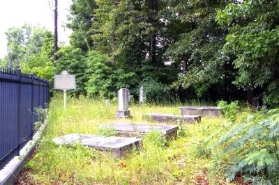
Location. 33° 54.083′ N, 84° 28.8′ W. Marker is near Smyrna, Georgia, in Cobb County. Marker is on Windy Hill Road, 0.1 miles east of North Park Place NW, on the right when traveling east. The marker is just inside a heavy fence enclosing the Hargrove Family Cemetery. Touch for map. Marker is in this post office area: Stone Mountain GA 30088, United States of America. Touch for directions.
Other nearby markers. At least 8 other markers are within 3 miles of this marker , measured as the crow flies. Genuine Parts Company (approx. 1½ miles away); Power's Ferry (approx. 2.1 miles away); The River Patrol & Cochran’s Ford (approx. 2.1 miles away); The Taylor-Brawner House (approx. 2.3 miles away); Battle of Smyrna (approx. 2.3 miles away); Smyrna Memorial Cemetery (approx. 2.3 miles away); Mazie Whitfield Nelson (approx. 2.4 miles away); Smyrna’s First Mayor (approx. 2.4 miles away). Touch for a list and map of all markers in Smyrna.
Credits. This page was last revised on June 16, 2016. It was originally submitted on July 21, 2010, by David Seibert of Sandy Springs, Georgia. This page has been viewed 1,694 times since then and 50 times this year. Photos: 1, 2, 3, 4. submitted on July 21, 2010, by David Seibert of Sandy Springs, Georgia. • Craig Swain was the editor who published this page.


