Ellicott City in Howard County, Maryland — The American Northeast (Mid-Atlantic)
St. John’s Episcopal Church
Photographed by F. Robby, December 29, 2003
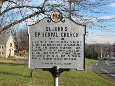
1. St. John's Episcopal Church Marker
Erected 1960 by The Maryland Historical Society.
Topics and series. This historical marker is listed in these topic lists: Colonial Era • Religion & Religious Structures. In addition, it is included in the Maryland Historical Trust series list. A significant historical year for this entry is 1728.
Location. 39° 16.351′ N, 76° 49.761′ W. Marker is in Ellicott City, Maryland, in Howard County. It is on Frederick Road (Maryland Route 144) 0.1 miles west of St. John's Lane, on the right when traveling west. Touch for map. Marker is in this post office area: Ellicott City MD 21042, United States of America. Touch for directions.

Regionally, this marker is in the Baltimore Metro Region and in Central Maryland. It is also in the American Mid-Atlantic and on the Eastern Seaboard. Globally, it is in the North Atlantic Region, North America, the Western Hemisphere,
this page online
Other nearby markers. At least 8 other markers are within walking distance of this marker: MacAlpine (about 700 feet away, measured in a direct line); Health Conditions in the 1800's (approx. 0.3 miles away); International Order of Odd Fellows (approx. 0.3 miles away); Samuel Whipps (approx. 0.3 miles away); Our Restoration Story (approx. 0.3 miles away); The White Oak (approx. 0.3 miles away); Cemetery Plant Traditions in the 1800s (approx. 0.3 miles away); Koreatown (approx. 0.4 miles away). Touch for a list and map of all markers in Ellicott City.
Photographed by Christopher Busta-Peck, September 7, 2007
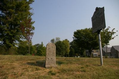
2. National Road milestone 12 M to B
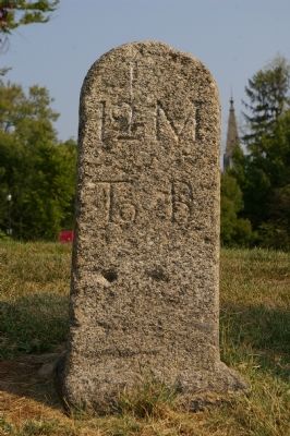
National Road milestone 12 M to B sits next to the historic marker. "12 M to B" indicates 12 miles to the beginning of the road, in downtown Baltimore.
Photographed by F. Robby, December 29, 2003
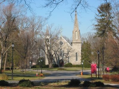
3. St. John's Church
Photographed by Christopher Busta-Peck
4. Detail of milestone 12 M to B
Credits. This page was last revised on December 28, 2024. It was originally submitted on November 6, 2007, by F. Robby of Baltimore, Maryland. This page has been viewed 2,315 times since then and 61 times this year. Photos: 1. submitted on November 6, 2007, by F. Robby of Baltimore, Maryland. 2. submitted on January 23, 2008, by Christopher Busta-Peck of Shaker Heights, Ohio. 3. submitted on November 6, 2007, by F. Robby of Baltimore, Maryland. 4. submitted on January 23, 2008, by Christopher Busta-Peck of Shaker Heights, Ohio. • J. J. Prats was the editor who published this page.
