Mole Lake in Forest County, Wisconsin — The American Midwest (Great Lakes)
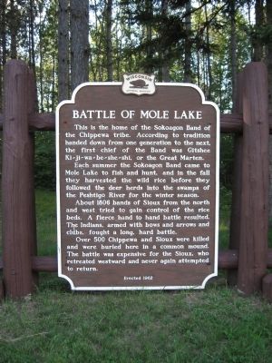
Battle of Mole Lake
Each summer the Sokoagon Band came to Mole Lake to fish and hunt, and in the fall they harvested the wild rice before they followed the deer herds into the swamps of the Peshtigo River for the winter season.
About 1806 bands of Sioux from the north and west tried to gain control of the rice beds. A fierce hand to hand battle resulted. The Indians, armed with bows and arrows and clubs, fought a long, hard battle.
Over 500 Chippewa and Sioux were killed and were buried here in a common mound. The battle was expensive for the Sioux, who retreated westward and never again attempted to return.
Erected 1962 by the Wisconsin Historical Society. (Marker Number 122.)
Topics and series. This historical marker is listed in these topic lists: Native Americans • Wars, US Indian. In addition, it is included in the Wisconsin Historical Society series list. A significant historical year for this entry is 1806.
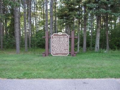
Location. 45° 29.157′ N, 88° 58.334′ W. Marker is in Mole Lake, Wisconsin, in Forest County. Marker is on State Highway 55, 0.7 miles north of County Highway M. Marker is located at a highway pull-off in the Sokaogon (Mole Lake) Reservation. Touch for map. Marker is in this post office area: Crandon WI 54520, United States of America. Touch for directions.
Other nearby markers. At least 5 other markers are within 13 miles of this marker, measured as the crow flies. Mecikalski Stovewood Building (approx. 5 miles away); Northern Highland (approx. 8.7 miles away); Tolling Bell (approx. 10.3 miles away); Old Military Road (approx. 11 miles away); Langlade County Forest (approx. 12.6 miles away).
Also see . . . Mole Lake Sokaogon Chippewa Community. (Submitted on July 23, 2010.)
Additional keywords. Sokaogon
Credits. This page was last revised on June 16, 2016. It was originally submitted on July 23, 2010, by Keith L of Wisconsin Rapids, Wisconsin. This page has been viewed 2,602 times since then and 216 times this year. Last updated on July 23, 2010, by William J. Toman of Green Lake, Wisconsin. Photos: 1, 2. submitted on July 23, 2010, by Keith L of Wisconsin Rapids, Wisconsin. • Craig Swain was the editor who published this page.

