Near Elmira in Chemung County, New York — The American Northeast (Mid-Atlantic)
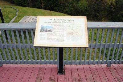
The Sullivan Campaign
July 31 to October 15, 1779
— One of the Revolutionary War's Largest Campaigns —
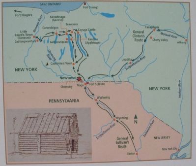
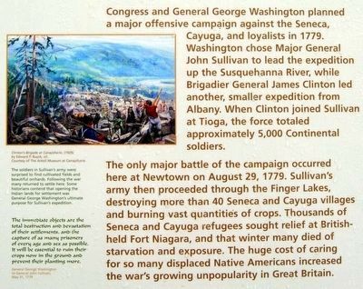
Congress and General George Washington planned a major offensive campaign against the Seneca, Cayuga, and loyalists in 1779. Washington chose Major General John Sullivan to lead the expedition up the Susquehanna River, while Brigadier General James Clinton led another, smaller expedition from Albany. When Clinton joined Sullivan at Tioga, the force totaled approximately 5,000 Continental sodiers.
The only major battle of the campaign occurred here at Newtown on August 29, 1779. Sullivan's army then proceeded through the Finger Lakes destroying more than 40 Seneca and Cayuga villages and burning vast quantities of crops. Thousands of Seneca and Cayuga refugees sought relief at British-held Fort Niagara, and that winter many died of starvation and exposure. The huge cost of caring for so many displaced Native Americans increased the war's growing unpopularity in Great Britain.
(Left Sidebar):
The soldiers in Sullivan's army were surprised to find cultivated fields and beautiful orchards. Following the war many returned to settle here. Some historians contend that opening the Indian lands for settlement was General George Washington's ultimate purpose for Sullivan's expedition.
The immediate objects are the total destruction and devastation of their settlements, and the capture of as many prisoners of every age and sex as possible. It will be essential to ruin their crops now in the ground and prevent their planting more.
General George Washington to General John Sullivan, May 31, 1779.
(Right Sidebar):
I am clear in opinion that the cheapest... and most effectual means of opposing [the Indians and loyalists]... is to carry the war into their own country. For, supported on the one hand by the British and enriching themselves with the spoils of our peoples, they have everything to gain and nothing to lose, while we act on the defensive, whereas the direct reverse would be the consequence of an offensive war on our part.
General George Washington to Continental Congress Conference Convention, February 11, 1779.
Topics and series. This historical marker is listed in these topic lists: Native Americans • War, US Revolutionary. In addition, it is included in the Former U.S. Presidents: #01 George Washington, and the The Sullivan-Clinton Expedition Against the Iroquois Indians series lists. A significant historical year for this entry is 1779.
Location. 42° 2.667′ N, 76° 43.966′ W. Marker is near Elmira, New York, in Chemung County. Marker is on Newtown Reservation Road. Located at Newtown Battlefield Reservation State Park. Touch for map. Marker is in this post office area: Elmira NY 14901, United States of America. Touch for directions.
Other nearby markers. At least 10 other markers are within walking distance of this marker. Fire on the Frontier - 1778 (here, next to this marker); The Battle of Newtown (here, next to this marker); Divided Peoples (a few steps from this marker); Major General John Sullivan (within shouting distance of this marker); Flagstaffs - Newtown Battlefield (about 300 feet away, measured in a direct line); a different marker also named The Battle of Newtown (about 400 feet away); Newtown Battlefield Reservation (about 500 feet away); A Civil Rights Victory (about 700 feet away); Newtown (approx. 0.4 miles away); Routes of the Armies / Newtown 1779 (approx. 0.8 miles away). Touch for a list and map of all markers in Elmira.
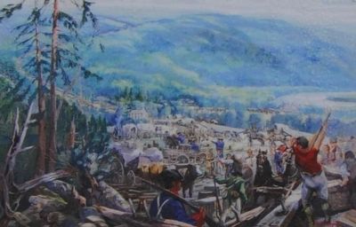
More about this marker. On the left is a depiction of Clinton's Brigade at Canajoharie, by Edward P. Buyck. On the right is a map showing the movements during the campaign. Clinton's brigade joined Sullivan's army at Tioga. From there, the army proceeded north and west through the Finger Lakes. A sketch inserted into the map is captioned, Lieutenant Colonel Adam Hubley sketched this "Indian House" at Genesee (also called Little Beard's Town) in his journal. He noted "107 well finished houses." Sullivan's army occupied and destroyed the village on September 14, 1779.
Also see . . . The Sullivan Campaign. Varsity Tutors website entry:
A Little-Known Offensive Strategic To The War Breaks The Indian Nations' Power. (Submitted on July 25, 2010, by Craig Swain of Leesburg, Virginia.)
Credits. This page was last revised on February 3, 2022. It was originally submitted on July 25, 2010, by Craig Swain of Leesburg, Virginia. This page has been viewed 2,200 times since then and 82 times this year. Photos: 1, 2. submitted on July 25, 2010, by Craig Swain of Leesburg, Virginia. 3, 4, 5. submitted on November 6, 2015, by Brian Scott of Anderson, South Carolina. 6. submitted on July 25, 2010, by Craig Swain of Leesburg, Virginia. 7, 8. submitted on November 6, 2015, by Brian Scott of Anderson, South Carolina.

