Stanton in Mercer County, North Dakota — The American Midwest (Upper Plains)
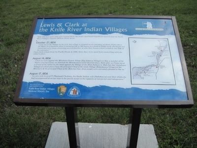
Lewis & Clark at the Knife River Indian Villages
Lewis & Clark in North Dakota
Inscription.
With 168 days and 1,600 miles behind them, the Lewis and Clark Expedition arrived near the Knife River Villages. Captain William Clark wrote:
October 27, 1804
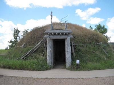
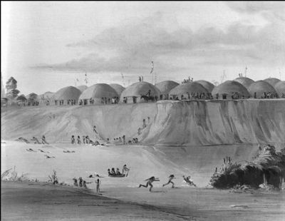
"came too at the Village on the L.S. this village is situated on an eminance of about 50 feet above the Water in a handsome plain it containes [40 or 50] houses in a kind of Picket work, the houses are round and verry large containing several families, as also their horses which is tied on one Side of the enterance,"
Upon thier return from the Pacific Ocean in 1806, three days were spent here counselling with the tribal leaders.
August 14, 1806
"when we were opposit the Minetares Grand Village [Big Hidatsa Village] we Saw a number of the Nativs viewing of [us]. we derected the Blunderbuses fired Several times, Soon after we Came too at a Croud of the nativs on the bank opposit the Village of the Shoe Indians or Mah-har-has' [Amahami Village] at which place I saw the principal Chief of the Little Village [Sakakawea Village] of the Menitarre & the principal Chief of the Mah-har-has. those people were extreamly pleased to See us."
August 17, 1806
"we also took leave of T.[Touisant] Chabono, his Snake Indian wife [Sakakawea] and their child who had accompanied us on our rout to the pacific ocean in the capacity of interpreter and interpretres."
Erected by Knife River Indian Villages National Historic Site, National Park Service and Lewis and Clark National Trails Association.
Topics and series. This historical marker is listed in these topic lists: Exploration • Native Americans • Settlements & Settlers • Waterways & Vessels. In addition, it is included in the Lewis & Clark Expedition series list. A significant historical month for this entry is October 1930.
Location. 47° 19.901′ N, 101° 23.077′ W. Marker is in Stanton, North Dakota, in Mercer County. Marker is on County Route 31, on the right when traveling north. Touch for map. Marker is in this post office area: Stanton ND 58571, United States of America. Touch for directions.
Other nearby markers. At least 8 other markers are within walking distance of this marker. Hidatsa Garden (here, next to this marker); Tobacco (about 300 feet away, measured in a direct line); Awatixa Xi'e Village (about 600 feet away); Middens (approx. 0.2 miles away); Feeding the River (approx. half a mile away); Awatixa Village (approx. half a mile away); Cutbank Archeaology (sic) (approx. 0.6 miles away); River-Centered (approx. 0.6 miles away). Touch for a list and map of all markers in Stanton.
Regarding Lewis & Clark at the Knife River Indian Villages. Village Life
in the Upper Missouri River Valley (c. 1740-1845)
(This material was produced by the National Park Service and can be found on the NPS website for the Knife River Indian Villages Park.)
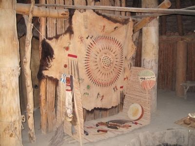
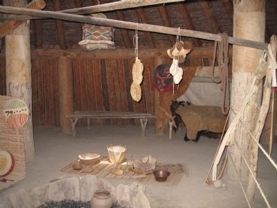
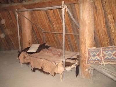
The Mandan, Hidatsa, and Arikara tribes shared a culture superbly adapted to the conditions of the Upper Missouri River valley. Their summer villages, located on natural terraces above the river, were ordered communities with as many as 120 earthlodges. An earthlodge is a circular, earth-covered structure which usually has its entire interior area dug out to one foot below the ground surface. Each earthlodge sheltered an extended family of 10 to 30 people from the region's extreme temperatures. The summer villages were strategically located for defense, often on a narrow bluff with water on two sides and a palisade (a fence of upright logs or poles set on end into the ground for enclosure or defense) on the third. In winter the inhabitants moved into smaller lodges along the bottomlands, where trees provided firewood and protection from the cold wind.
In this village society, men lived in the household of their wives, bringing only their clothes, horses, and weapons. Women built, owned, and maintained the lodges and owned the gardens, gardening tools, food, dogs, and horses. Related lodge families from numerous villages made up clans, whose members were expected to help and guide each other but who were forbidden to marry other clan members. Clans were competitive, especially in war, but it was the age-grade societies, transcending village and clan, that were looked to for personal prestige. Young men purchased membership in the lowest society at 12 or 13 years of age, progressing to higher and more expensive levels as they reached the proper age. Besides serving as warrior bands, each group was responsible for a social function: policing the village, scouting, or planning the hunt. Most important, the age-grade societies were a means of social control, setting standards of behavior and transmitting tribal lore and custom.
Also see . . . Knife River Indian Villages National Historic Site. (Submitted on July 23, 2010, by David Bullard of Seneca, South Carolina.)
Credits. This page was last revised on November 29, 2019. It was originally submitted on July 23, 2010, by David Bullard of Seneca, South Carolina. This page has been viewed 1,927 times since then and 46 times this year. Last updated on July 26, 2010, by David Bullard of Seneca, South Carolina. Photos: 1, 2, 3, 4, 5, 6, 7, 8. submitted on July 23, 2010, by David Bullard of Seneca, South Carolina. • Syd Whittle was the editor who published this page.
