Near Middletown in Frederick County, Virginia — The American South (Mid-Atlantic)
The Battle of Cedar Creek
Photographed By Craig Swain, September 29, 2007
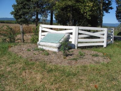
1. The Battle of Cedar Creek Marker
Virtual Tour of the Battle of Cedar Creek by HMDb Markers
Click for more information.
Click for more information.
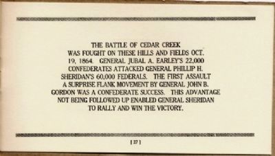
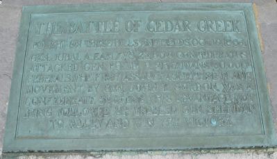
Fought on these hills and fields, Oct 19, 1864. Gen. Jubal A. Early's 22,000 Confederates attacked Gen. Philip H. Sheridan's 60,000 Federals. The first assault a surprise flank movement by Gen. John B. Gordon, was a Confederate success. This advantage not being followed up, enabled Gen. Sheridan to rally and win the victory.
Topics and series. This historical marker is listed in this topic list: War, US Civil. In addition, it is included in the Battlefield Markers Association series list. A significant historical year for this entry is 1864.
Location. 39° 0.886′ N, 78° 18.088′ W. Marker is near Middletown, Virginia, in Frederick County. Marker is at the intersection of Valley Pike (U.S. 11) and Belle Grove Road (County Route 727), on the right when traveling south on Valley Pike. Touch for map. Marker is in this post office area: Middletown VA 22645, United States of America. Touch for directions.
Other nearby markers. At least 8 other markers are within walking distance of this marker. Ramseur Monument (within shouting distance of this marker); a different marker also named Battle of Cedar Creek (about 600 feet away, measured in a direct line); Eve of Battle (about 600 feet away); Tomb Of An Unknown Soldier (about 700 feet away); Union Camps (approx. ¼ mile away); Battlefield Center (approx. ¼ mile away); a different marker also named Battle of Cedar Creek (approx. ¼ mile away); Cedar Creek (approx. 0.3 miles away). Touch for a list and map of all markers in Middletown.
Regarding The Battle of Cedar Creek. The Cedar Creek battlefield is interpreted by several markers. See the Battle of Cedar Creek Virtual Tour by Markers link above.
Also see . . .
1. Battle of Cedar Creek. Cedar Creek Battlefield Foundation website homepage (Submitted on November 7, 2007, by Craig Swain of Leesburg, Virginia.)
2. The Battle of Cedar Creek Self-guided Tour. Center of Military History, United States Army PDF (Submitted on July 6, 2023, by Larry Gertner of New York, New York.)
3. McInturff's Ford. This portion of the battlefield is discussed as tour stop 3 of the Center of Military History staff ride guide. (Submitted on November 7, 2007, by Craig Swain of Leesburg, Virginia.)
4. Cedar Creek. The Confederate river crossings are discussed as part of phase two of this National Parks Summary of the battle. (Submitted on November 7, 2007, by Craig Swain of Leesburg, Virginia.)
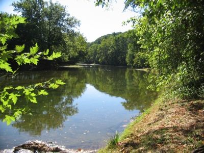
Photographed By Craig Swain, September 29, 2007
3. McIntruff's Ford
Gordon's Confederate Division crossed the North Fork of the Shenandoah River here just downstream from the mouth of Cedar Creek (on the right). The march and crossing was a rare, for the Civil War, night tactical maneuver executed to near perfection. Guides were posted to direct the marching column, as well as marking signs along the route. After the crossing the river, the column proceeded along farm lanes to the north on the flank of the VIII Federal Corps camps.
Photographed By Craig Swain, September 29, 2007
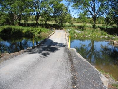
4. Bowman's Mill Ford
Crossed today by Bowman's Mill Road (County Route 635), Confederates in Kershaw's Division made their way across Cedar Creek here in the early morning hours of October 19, 1864. They advanced up the bank on the far side and into positions to confront Thoburn's Federal Division of the VIII Corps.
Credits. This page was last revised on July 6, 2023. It was originally submitted on November 7, 2007, by Craig Swain of Leesburg, Virginia. This page has been viewed 2,236 times since then and 48 times this year. Photos: 1, 2, 3, 4. submitted on November 7, 2007, by Craig Swain of Leesburg, Virginia. 5. submitted on December 9, 2008, by Bernard Fisher of Richmond, Virginia.
