Buckroe Beach in Hampton, Virginia — The American South (Mid-Atlantic)
Buckroe
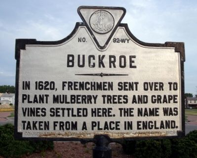
Photographed by Bernard Fisher, July 31, 2010
1. Buckroe Marker
Erected 1928 by Conservation & Development Commission. (Marker Number WY-92.)
Topics and series. This historical marker is listed in these topic lists: Colonial Era • Settlements & Settlers. In addition, it is included in the Virginia Department of Historic Resources (DHR) series list. A significant historical year for this entry is 1620.
Location. 37° 2.454′ N, 76° 17.562′ W. Marker is in Hampton, Virginia. It is in Buckroe Beach. It is at the intersection of East Pembroke Avenue and South 2nd Street, in the median on East Pembroke Avenue. Touch for map. Marker is in this post office area: Hampton VA 23669, United States of America. Touch for directions.

Regionally, this marker is on Virginia’s Peninsula and in Coastal Virginia. It is also in the American South, specifically in the Upper South, in the Tidewater, and on the Eastern Seaboard. Globally, it is in the North Atlantic Region, North America, the Western Hemisphere, the Western World, and the Anglosphere. Historically,
this page online
Other nearby markers. At least 8 other markers are within 3 miles of this marker, measured as the crow flies: Buckroe Beach (about 300 feet away, measured in a direct line); a different marker also named Buckroe Beach (about 600 feet away); Bay Shore Hotel (approx. 0.3 miles away); Virginia Green Book Location (approx. 0.3 miles away); Bay Shore Beach & Resort (approx. 0.3 miles away); Harbor Defense Regimental Distinctive Insignia (approx. 2 miles away); Chesapeake & Ohio (approx. 2.1 miles away); Phoebus - The Gateway To The New World (approx. 2.2 miles away). Touch for a list and map of all markers in Hampton.
Also see . . .
1. Buckroe Beach Community News. (Submitted on August 1, 2010, by Bernard Fisher of Richmond, Virginia.)
2. Save Buckroe Beach. Buckroe Beach Bayfront Park Committee (Submitted on August 1, 2010, by Bernard Fisher of Richmond, Virginia.)
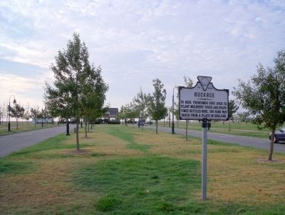
Photographed by Bernard Fisher, July 31, 2010
2. E Pembroke Ave & S 2nd St
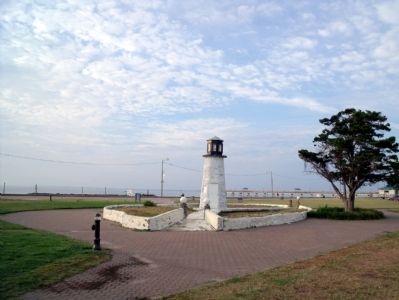
Photographed by Bernard Fisher, July 31, 2010
3. Buckroe Beach
Credits. This page was last revised on February 1, 2023. It was originally submitted on August 1, 2010, by Bernard Fisher of Richmond, Virginia. This page has been viewed 1,663 times since then and 41 times this year. Photos: 1, 2, 3. submitted on August 1, 2010, by Bernard Fisher of Richmond, Virginia.
