Downtown in Hampton, Virginia — The American South (Mid-Atlantic)
Third Elizabeth City Parish Church
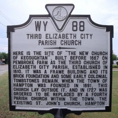
Photographed by Bernard Fisher, July 31, 2010
1. Third Elizabeth City Parish Church Marker
Erected 1950 by Virginia Conservation Commission. (Marker Number WY-88.)
Topics. This historical marker is listed in these topic lists: Colonial Era • Religion & Religious Structures. A significant historical year for this entry is 1667.
Location. 37° 1.707′ N, 76° 21.633′ W. Marker is in Hampton, Virginia. It is in Downtown. It is at the intersection of West Pembroke Avenue and Patterson Avenue, on the right when traveling west on West Pembroke Avenue. Touch for map. Marker is in this post office area: Hampton VA 23669, United States of America. Touch for directions.

Regionally, this marker is on Virginia’s Peninsula and in Coastal Virginia. It is also in the American South,
this page online
Other nearby markers. At least 8 other markers are within walking distance of this marker: Third Church at Kecoughtan (within shouting distance of this marker); Black Business (approx. 0.6 miles away); Grand Contraband Camp (approx. 0.6 miles away); Electric Avenue (approx. 0.7 miles away); Historic St. John's Episcopal Church (approx. 0.7 miles away); Hannah Nicholson Tunnell (approx. ¾ mile away); St. John's Church (approx. ¾ mile away); Hampton Confederate Monument (approx. 0.8 miles away). Touch for a list and map of all markers in Hampton.
Also see . . . Brief History of St. John's Episcopal Church. (Submitted on August 1, 2010, by Bernard Fisher of Richmond, Virginia.)
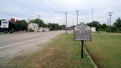
Photographed by Bernard Fisher, July 31, 2010
2. W Pembroke Ave & Patterson Ave
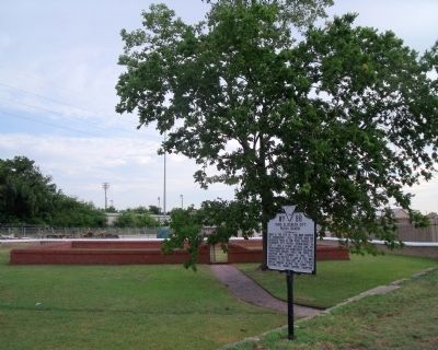
Photographed by Bernard Fisher, July 31, 2010
3. Third Elizabeth City Parish Church Site
Credits. This page was last revised on February 1, 2023. It was originally submitted on August 1, 2010, by Bernard Fisher of Richmond, Virginia. This page has been viewed 1,277 times since then and 42 times this year. Photos: 1, 2, 3. submitted on August 1, 2010, by Bernard Fisher of Richmond, Virginia.
