South Newport News , Virginia — The American South (Mid-Atlantic)
Camp Stuart
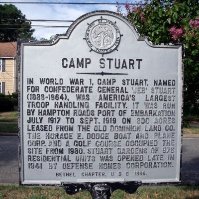
Photographed by Bernard Fisher, July 31, 2010
1. Camp Stuart Marker
Erected 1969 by Bethel Chapter, UDC.
Topics and series. This historical marker is listed in these topic lists: War, US Civil • War, World I. In addition, it is included in the United Daughters of the Confederacy, and the Virginia, Corporation of Newport News series lists. A significant historical year for this entry is 1917.
Location. 36° 58.777′ N, 76° 24.299′ W. Marker is in Newport News, Virginia. It is in South Newport News. It is at the intersection of Roanoke Avenue and 16th Street, in the median on Roanoke Avenue. Touch for map. Marker is in this post office area: Newport News VA 23607, United States of America. Touch for directions.

Regionally, this marker is on Virginia’s
this page online
Other nearby markers. At least 8 other markers are within walking distance of this marker: Norvleate Downing-Gross (approx. half a mile away); Ella Jane Fitzgerald (approx. half a mile away); Hampton Roads (approx. half a mile away); Monitor – Merrimack (approx. half a mile away); Birth of Naval Aviation (approx. half a mile away); Monitor – Merrimack Battle (approx. 0.6 miles away); Pearl Mae Bailey (approx. 0.6 miles away); Phillis Wheatley (approx. 0.6 miles away). Touch for a list and map of all markers in Newport News.
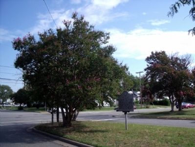
Photographed by Bernard Fisher, July 31, 2010
2. Roanoke Ave & 16th St

circa 1919
3. 338th Regiment, 1919 Camp Stuart, Va
My Step Father's Father - James Bllings is in this photo somewhere.

May 14, 2024
4. Camp Stuart Marker
I assume this was taken by a relative of mine, date unknown.
Credits. This page was last revised on May 15, 2024. It was originally submitted on August 3, 2010, by Bernard Fisher of Richmond, Virginia. This page has been viewed 5,575 times since then and 196 times this year. Photos: 1, 2. submitted on August 3, 2010, by Bernard Fisher of Richmond, Virginia. 3. submitted on March 5, 2018, by William R Harbin of Memphis, Tennessee. 4. submitted on May 14, 2024, by Rose E. Bingham of Reedsburg, Wisconsin 53959.
