
Greensboro in Caroline County, Maryland — The American Northeast (Mid-Atlantic)
Peter Harrington
Revolutionary Officer, founder of Greensboro
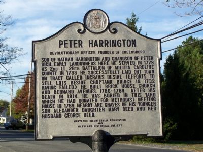
Photographed by Beverly Pfingsten, November 3, 2007
1. Peter Harrington Marker
Erected by Maryland Bicentennial Commission & Maryland Historical Society.
Topics and series. This historical marker is listed in these topic lists: Cemeteries & Burial Sites • Settlements & Settlers • War, US Revolutionary. In addition, it is included in the Maryland Historical Trust series list. A significant historical year for this entry is 1778.
Location. 38° 58.563′ N, 75° 48.26′ W. Marker is in Greensboro, Maryland, in Caroline County. It is at the intersection of Md 480 Main Street and Cedar Lane, on the right when traveling south on Md 480 Main Street. Touch for map. Marker
this page online

Regionally, this marker is on the Eastern Shore. It is also in the American Mid-Atlantic, on the Delmarva Peninsula, in the Tidewater, and on the Eastern Seaboard. Globally, it is in the North Atlantic Region, North America, the Western Hemisphere, the Western World, and the Anglosphere. Historically, it finds itself in what was once one of the original Thirteen Colonies and also the Antebellum South.
Other nearby markers. At least 8 other markers are within 5 miles of this marker, measured as the crow flies: Letter to Lincoln (about 400 feet away, measured in a direct line); Goldsborough House (approx. 0.2 miles away); Greensboro Veterans Memorial Park (approx. ¼ mile away); Choptank River Park (approx. 0.3 miles away); a different marker also named Greensboro (approx. 0.3 miles away); Saulsbury House - Fifer Hospital - Ridgely House (approx. 4.7 miles away); Town of Ridgely Flag (approx. 4.7 miles away); The Drinking Fountain (approx. 4.8 miles away). Touch for a list and map of all markers in Greensboro.
Another marker
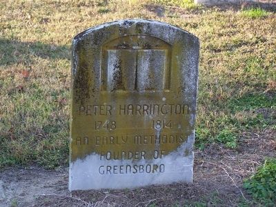
Photographed by Beverly Pfingsten, November 3, 2007
2. Grave of Peter Harrington
Peter Harrington
Early Methodist
Founder of
Greensboro
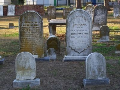
Photographed by Beverly Pfingsten, November 3, 2007
3. Other Harrington graves in cemetery.
Credits. This page was last revised on November 22, 2019. It was originally submitted on November 7, 2007, by Bill Pfingsten of Bel Air, Maryland. This page has been viewed 2,676 times since then and 30 times this year. Photos: 1, 2, 3. submitted on November 7, 2007, by Bill Pfingsten of Bel Air, Maryland.
