Seaford in York County, Virginia — The American South (Mid-Atlantic)
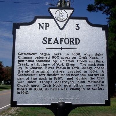
Seaford
Erected 1992 by Department of Historic Resources. (Marker Number NP-3.)
Topics and series. This historical marker is listed in these topic lists: Churches & Religion • Colonial Era • Settlements & Settlers • War, US Civil. In addition, it is included in the Virginia Department of Historic Resources (DHR) series list. A significant historical year for this entry is 1636.
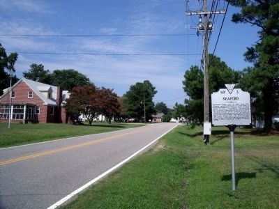
Location. 37° 11.693′ N, 76° 25.979′ W. Marker is in Seaford, Virginia, in York County. Marker is at the intersection of Seaford Road (Virginia Route 622) and Wornom Drive, on the right when traveling east on Seaford Road. Touch for map. Marker is at or near this postal address: 2108A Seaford Rd, Seaford VA 23696, United States of America. Touch for directions.
Other nearby markers. At least 8 other markers are within 4 miles of this marker, measured as the crow flies. Goodwin Neck (approx. 1.2 miles away); American Encampment (approx. 3˝ miles away); Moore House (approx. 3˝ miles away); Major General Benjamin Lincoln and His Division (approx. 3˝ miles away); Wear Of Centuries (approx. 3.6 miles away); Virginia Militia (approx. 3.6 miles away); Wormley Creek Crossing (approx. 3.6 miles away); American Approach Road (approx. 3.7 miles away).
Credits. This page was last revised on July 14, 2021. It was originally submitted on August 4, 2010, by Bernard Fisher of Richmond, Virginia. This page has been viewed 1,003 times since then and 69 times this year. Photos: 1, 2. submitted on August 4, 2010, by Bernard Fisher of Richmond, Virginia.

