Rowlesburg in Preston County, West Virginia — The American South (Appalachia)
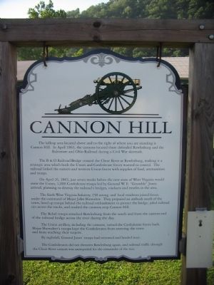
Cannon Hill
The B&O Railroad crossed the Cheat River at Rowlesburg, making it a strategic area which both the Union and Confederate forces wanted to control. The railroad linked the eastern and western Union forces with supplies of food, ammunition and troops.
On April 26, 1863, just weeks before the new state of West Virginia would enter the Union, 1,000 Confederate troops led by General W.E. "Grumble" Jones arrived, planning to destroy the railroad's bridges, viaducts and trestles in the area.
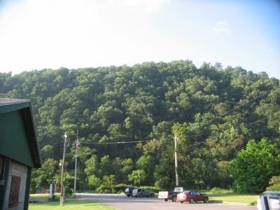
The Sixth West Virginia Infantry, 250 strong and local residents joined forces under the command of Major John Showalter. They prepared an ambush south of the town, lined up troops behind the railroad embankment to protect the bridge, piled railroad ties across the tracks, and readied the cannons atop Cannon Hill.
The Rebel troops attacked Rowlesburg from the south and from the eastern end of the railroad bridge across the river during the day.
The Union artillery, including the cannons, turned the Confederate forces back. Major Showalter's troops kept the Confederates from entering the town and from reaching their targets.
By nightfall, General Jones' troops had retreated and headed west.
The Confederates did not threaten Rowlesburg again, and railroad traffic through the Cheat River canyon was unimpeded for the remainder of the war.
Topics. This historical marker is listed in this topic list: War, US Civil. A significant historical month for this entry is April 1863.
Location. 39° 20.917′ N, 79° 40.265′ W. Marker is in Rowlesburg, West Virginia, in Preston County. Marker is at the intersection of Catherine Street (State Highway 72) and Buffalo Street, on the right when traveling west on Catherine Street. Touch for map. Marker is in this post office area: Rowlesburg WV 26425, United States of America. Touch for directions.
Other nearby markers. At least 8 other markers are within walking distance of this marker. Rowlesburg Community Park (within shouting distance of this marker); Restoring the American Chestnut Tree (within shouting distance of this marker); Rowlesburg School (within shouting distance of this marker); The Great Flood of November 4-5, 1985 (about 500 feet away, measured in a direct line); Rowlesburg Area Honor Roll (about 600 feet away); Independent Order of Odd Fellows Building and Property (about 600 feet away); 34 South Church Street (about 700 feet away); 32 South Church Street (about 700 feet away). Touch for a list and map of all markers in Rowlesburg.
Credits. This page was last revised on June 16, 2016. It was originally submitted on August 4, 2010, by Craig Swain of Leesburg, Virginia. This page has been viewed 991 times since then and 21 times this year. Photos: 1, 2, 3. submitted on August 4, 2010, by Craig Swain of Leesburg, Virginia.


