Rutherfordton in Rutherford County, North Carolina — The American South (South Atlantic)
Rutherfordton
ď . . . did it no goodĒ
ó Stonemanís Raid ó
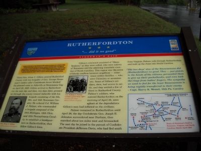
Union Gen. Alvan C. Gillem entered Rutherford County with two brigades of Gen. George Stoneman's raiders after Confederate forces blocked his planned route to Asheville at Swannanoa Gap on April 20, 1865. Gillem arrived in Rutherfordton the next day and then, two days later, pressed on through the county toward Asheville with his brigade consisting of the 8th, 9th, and 13th Tennessee Cavalry. He ordered Col. William J. Palmer, who commanded a brigade composed of the 10th Michigan, 12th Ohio, and 15th Pennsylvania Cavalry, to establish a headquarters in Rutherfordton, then follow Gillemís force.
Gillemís command consisted of “Home Yankees,” as they were called, who were natives of Tennessee and the adjoining mountain counties of North Carolina. This region was the scene of bloody conflicts between neighbors – sometimes within families – who were Unionists or secessionists. Some of Gillemís soldiers, then, had scores to settle, and they settled a few of them in Rutherford County. Palmerís soldiers, who entered Rutherfordton on the morning of April 25, were aghast at the depredations Gillemís men had inflicted on the civilians.
Palmer remained in Rutherfordton until April 26, the day Confederate Gen. Joseph E. Johnston surrendered near Durham, then marched about ten miles west and bivouacked. The next day he joined in the pursuit of Confederate President Jefferson Davis, who had fled south from Virginia. Palmer rode through Rutherfordton and took up the chase into South Carolina.
“The two daysí stay of the Tennesseeans did [Rutherfordton] no good. They . . . put pistols to the heads of the citizens, persuaded them to give up their pocketbooks, and even took the rings from ladiesí fingers. The sympathy we used to feel for the loyal Tennesseeans is being rapidly transferred to their enemy.”
Erected by Civil War Trails.
Topics and series. This historical marker is listed in this topic list: War, US Civil. In addition, it is included in the North Carolina Civil War Trails series list. A significant historical month for this entry is March 1980.
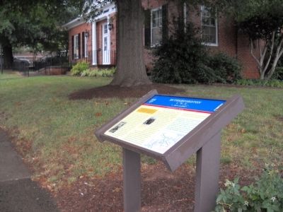
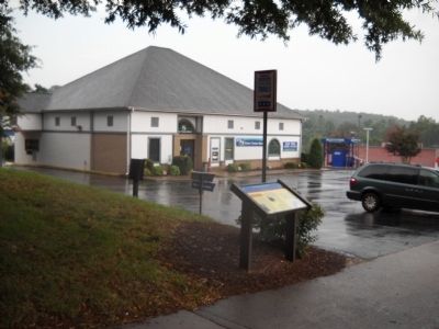
Location. 35° 21.979′ N, 81° 57.445′ W. Marker is in Rutherfordton, North Carolina, in Rutherford County. Marker is on N Main Street (U.S. 221) when traveling north. Marker is located between Charlotte Road and Trade Street, in front of the Norris Public Library. Touch for map. Marker is in this post office area: Rutherfordton NC 28139, United States of America. Touch for directions.
Other nearby markers. At least 8 other markers are within walking distance of this marker. Rutherford County (approx. 0.2 miles away); Rutherfordton Confederate Monument (approx. 0.2 miles away); First Baptist Church (approx. ľ mile away); Carrier-Ward House (approx. ľ mile away); Stoneman's Raid (approx. ľ mile away); Carrier-McBrayer House (approx. ľ mile away); James Adair (approx. 0.3 miles away); St. John's Episcopal Church (approx. 0.4 miles away). Touch for a list and map of all markers in Rutherfordton.
More about this marker. The bottom right of the marker contains a map indicating the locations of Civil War Trails sites for the Route of Stonemanís Raid in Tennessee, Virginia, and North Carolina, March – April 1865. The bottom left of the marker features a photograph of Gen. Alvan C. Gillem, Courtesy of Library of Congress, and near this is a photo of seven Union officers, including Col.William J. Palmer (seated, second from right) Courtesy U.S. Army Military History Institute.
Also see . . . Major General George Stoneman Led the Last American Civil War Cavalry Raid. HistoryNew.com website. (Submitted on August 5, 2010, by Bill Coughlin of Woodland Park, New Jersey.)
Credits. This page was last revised on March 9, 2021. It was originally submitted on August 5, 2010, by Bill Coughlin of Woodland Park, New Jersey. This page has been viewed 1,118 times since then and 27 times this year. Photos: 1, 2, 3. submitted on August 5, 2010, by Bill Coughlin of Woodland Park, New Jersey.


