Solomons in Calvert County, Maryland — The American Northeast (Mid-Atlantic)
Calvert County
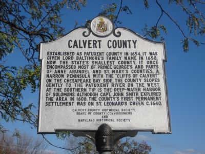
Photographed by F. Robby, November 7, 2007
1. Calvert County Marker
Erected by Calvert County Historical Society, Board of County Commissioners, Maryland Historical Society.
Topics and series. This historical marker is listed in these topic lists: Colonial Era • Political Subdivisions • Settlements & Settlers. In addition, it is included in the Maryland Historical Trust series list. A significant historical year for this entry is 1654.
Location. 38° 19.87′ N, 76° 27.957′ W. Marker is in Solomons, Maryland, in Calvert County. It is at the intersection of Solomons Island Road (Maryland Route 2) and Lore Road, on the right when traveling south
this page online

Regionally, this marker is in Southern Maryland. It is also in the American South, specifically in the Upper South, in the Mid-Atlantic, in the Tidewater, in the Chesapeake Bay Region, and on the Eastern Seaboard. Globally, it is in the North Atlantic Region, North America, the Western Hemisphere, the Western World, and the Anglosphere. Historically, it finds itself in what was once one of the original Thirteen Colonies and also the Antebellum South.
Other nearby markers. At least 8 other markers are within walking distance of this marker: Perils along the Patuxent (within shouting distance of this marker); The Honor Tree (within shouting distance of this marker); This Is A Sundial (about 300 feet away, measured in a direct line); Drum Point Lighthouse (about 400 feet away); Volunteer (about 400 feet away); Founders of the Calvert Marine Museum (about 500 feet away); The Ark of Hungerford Creek (about 500 feet away); War in the Chesapeake
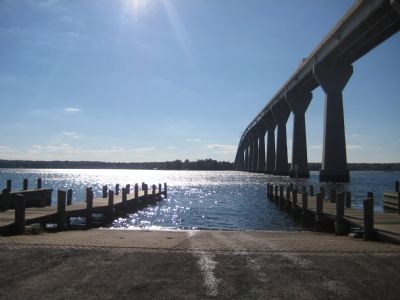
Photographed by F. Robby, November 7, 2007
2. Patuxent River at Solomons
View of the Patuxent from the Visitor Center.
Other markers no longer nearby. Anchor (was within shouting distance of this marker but has been permanently removed); a different marker also named Anchor (was within shouting distance of this marker but has been permanently removed); a different marker also named The Ark of Hungerford Creek (was about 500 feet away but has been replaced with another marker now near it).
Regarding Calvert County. There is an identical marker at Visitor Center at the northern end of the county in Owings 100 feet north of the intersection of Southern Maryland Boulevard and Chaneyville Road.
Credits. This page was last revised on October 13, 2025. It was originally submitted on November 9, 2007, by F. Robby of Baltimore, Maryland. This page has been viewed 1,446 times since then and 38 times this year. Photos: 1, 2. submitted on November 9, 2007, by F. Robby of Baltimore, Maryland. • J. J. Prats was the editor who published this page.
