Raven Rock in Hunterdon County, New Jersey — The American Northeast (Mid-Atlantic)
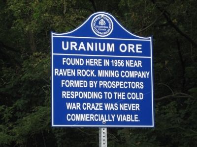
Uranium Ore
Erected 2010 by Hunterdon County Cultural And Heritage Commission.
Topics and series. This historical marker is listed in this topic list: War, Cold. In addition, it is included in the New Jersey, Hunterdon County Cultural and Heritage Commission series list. A significant historical year for this entry is 1956.
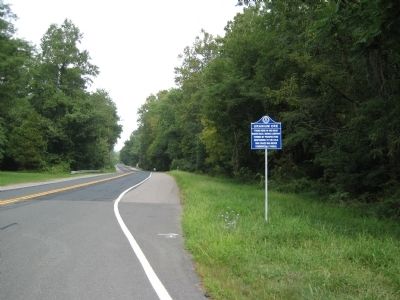
Location. 40° 24.659′ N, 75° 2.027′ W. Marker is in Raven Rock, New Jersey, in Hunterdon County. Marker is at the intersection of Daniel Bray Highway (New Jersey Route 29) and Quarry Road, on the right when traveling north on Daniel Bray Highway. Touch for map. Marker is at or near this postal address: 2188 Daniel Bray Highway, Stockton NJ 08559, United States of America. Touch for directions.
Other nearby markers. At least 8 other markers are within 2 miles of this marker, measured as the crow flies. Delaware & Raritan Canal (about 700 feet away, measured in a direct line); Lumberville - Ravenrock Toll-Supported Pedestrian Bridge (approx. ¼ mile away); Martin Johnson Heade (approx. 0.3 miles away in Pennsylvania); Delaware Canal / Pennsylvania Canal (approx. 0.4 miles away in Pennsylvania); Saxtonville Tavern (approx. 0.4 miles away); Rosemont - Raven Rock Bridge (approx. 0.9 miles away); Farm of Lloyd B. Wescott (approx. 1.7 miles away); Carversville Historic District (approx. 1.8 miles away in Pennsylvania). Touch for a list and map of all markers in Raven Rock.
Credits. This page was last revised on June 16, 2016. It was originally submitted on August 10, 2010, by Alan Edelson of Union Twsp., New Jersey. This page has been viewed 1,739 times since then and 31 times this year. Photos: 1, 2. submitted on August 10, 2010, by Alan Edelson of Union Twsp., New Jersey. • Syd Whittle was the editor who published this page.

