Near Williamsville in Bath County, Virginia — The American South (Mid-Atlantic)
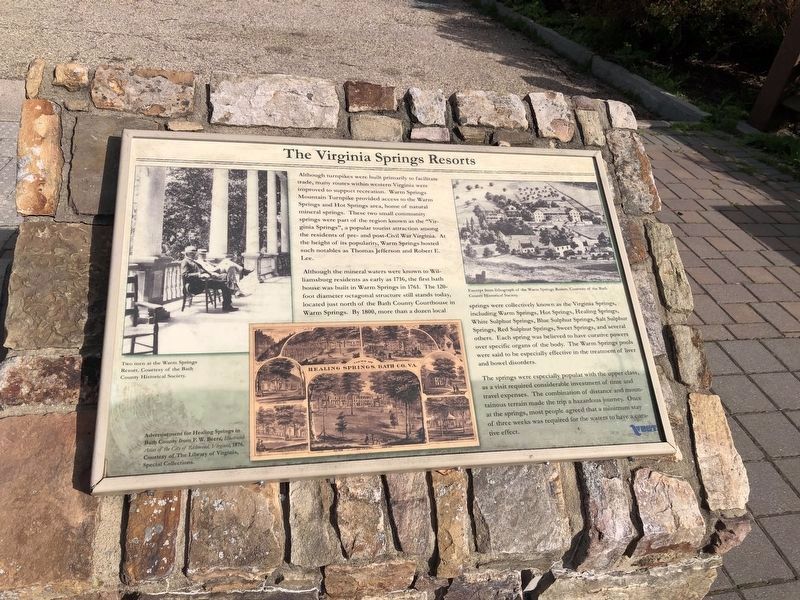
The Virginia Springs Resorts
Although the mineral waters were known to Williamsburg residents as early as 1716, the first bath house was built in Warm Springs in 1761. The 120-foot diameter octagonal structure still stands today, located just north of the Bath County Courthouse in Warm Springs. By 1800, more than a dozen local springs were collectively known as the Virginia Springs, including Warm Springs, Hot Springs, Healing Springs, White Sulphur Springs, Blue Springs, Salt Sulphur Springs, Red Sulphur Springs, Sweet Springs, and several others. Each spring was believed to have curative powers over specific organs of the body. The Warm Springs pools were said to be especially effective in the treatment of liver and bowel disorders.
The springs were especially popular with the upper class, as a visit required considerable investment of time and travel expenses. The combination of distance and mountainous terrain made the trip a hazardous journey. Once at the springs, most people agreed that a minimum stay of three weeks was required for the waters to have a curative effect.
Erected by Virginia Department of Transportation.
Topics. This historical marker is listed in this topic list: Natural Features. A significant historical year for this entry is 1716.
Location. 38° 3.065′ N, 79° 45.964′ W. Marker is near Williamsville, Virginia, in Bath County. Marker is at the intersection of State Highway 39 and Homestead Mountain Drive, on the right when traveling west on State Highway 39. Located at the Dan Ingalls Overlook in George Washington National Forest. Touch for map. Marker is in this post office area: Williamsville VA 24487, United States of America. Touch for directions.
Other nearby markers. At least 8 other markers are within walking distance of this marker. Settlement on Warm Springs Mountain (here, next to this marker); The Land and Natural Resources of Bath County (a few steps from this marker); Life at the Tollhouse (a few steps from this marker); The Turnpike Movement in Virginia, 1825-1835 (a few steps from this marker); The Rev. Dr. William H. Sheppard (approx. 0.8 miles away); Early Bath County Courthouses (approx. 0.8 miles away); Terrill Hill (approx. 0.8 miles away); Warm Springs Baths (approx. 0.8 miles away). Touch for a list and map of all markers in Williamsville.
Credits. This page was last revised on May 9, 2021. It was originally submitted on August 10, 2010, by Craig Swain of Leesburg, Virginia. This page has been viewed 1,058 times since then and 63 times this year. Photos: 1. submitted on May 9, 2021, by Devry Becker Jones of Washington, District of Columbia. 2. submitted on August 11, 2010, by Craig Swain of Leesburg, Virginia.

