Belington in Barbour County, West Virginia — The American South (Appalachia)
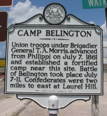
Camp Belington
Erected 1969 by West Virginia Historic Commission.
Topics and series. This historical marker is listed in this topic list: War, US Civil. In addition, it is included in the West Virginia Archives and History series list. A significant historical month for this entry is July 1861.
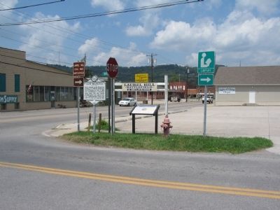
Location. 39° 1.418′ N, 79° 56.181′ W. Marker is in Belington, West Virginia, in Barbour County. Marker is at the intersection of Philippi Pike (U.S. 250) and Watkins Street (County Route 15), on the right when traveling north on Philippi Pike. Touch for map. Marker is in this post office area: Belington WV 26250, United States of America. Touch for directions.
Other nearby markers. At least 8 other markers are within 2 miles of this marker, measured as the crow flies. Camp Laurel Hill (here, next to this marker); Veterans Memorial (about 300 feet away, measured in a direct line); Meadowville (approx. half a mile away); Battle of Laurel Hill (approx. 0.6 miles away); Civil War on the Beverly & Fairmont Turnpike (approx. one mile away); a different marker also named Battle of Laurel Hill (approx. 1.6 miles away); Cannons (approx. 1.6 miles away); Confederate Cemetery (approx. 1.6 miles away). Touch for a list and map of all markers in Belington.
Credits. This page was last revised on June 16, 2016. It was originally submitted on August 14, 2010, by Craig Swain of Leesburg, Virginia. This page has been viewed 1,341 times since then and 47 times this year. Photos: 1. submitted on August 14, 2010, by Craig Swain of Leesburg, Virginia. 2. submitted on August 15, 2010, by Craig Swain of Leesburg, Virginia.

