
Oak Flat in Pendleton County, West Virginia — The American South (Appalachia)
Fort Seybert
Photographed by Craig Swain, July 10, 2010
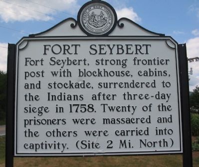
1. Fort Seybert Marker
Fort Seybert, strong frontier post with blockhouse, cabins, and stockade, surrendered to the Indians after three-day siege in 1758. Twenty of the prisoners were massacred and the others were carried into captivity. (Site 2 Mi. North)
Topics and series. This historical marker is listed in this topic list: War, French and Indian. In addition, it is included in the West Virginia Archives and History series list. A significant historical year for this entry is 1758.
Location. 38° 39.5′ N, 79° 12.868′ W. Marker is in Oak Flat, West Virginia, in Pendleton County. It is at the intersection of U.S. 33 and Sweedlin Valley Road (County Road 3), on the right when traveling west on U.S. 33. Touch for map. Marker is in this post office area: Brandywine WV 26802, United States of America. Touch for directions.

Regionally, this marker is in West Virginia’s Potomac Highlands. It is also in the American South, specifically in the Upper South, and in Appalachia. Globally, it is in North America, the Western Hemisphere, the Western World, and the Anglosphere. Historically, it finds itself in what was once the territory of
this page online
Other nearby markers. At least 8 other markers are within 7 miles of this marker, measured as the crow flies: Propst Lutheran Church (approx. 4.6 miles away); Murder of Ambrose Meadows (approx. 4.9 miles away); Rockingham County / West Virginia (approx. 6 miles away in Virginia); Franklin High School Cupola (approx. 6 miles away); Organized Pendleton County (approx. 6.3 miles away); William McCoy House (approx. 6.4 miles away); McCoy House (approx. 6.4 miles away); Franklin (approx. 6.4 miles away).
Another marker is no longer nearby. Murder of Ambrose Meadows (was approx. 4.9 miles away but has been replaced with another marker now near it).
Also see . . . Fort Seybert Massacre. West Virginia Archives and History website entry (Submitted on August 15, 2010, by Craig Swain of Leesburg, Virginia.)
Photographed by J. J. Prats, October 22, 2011
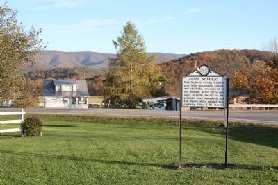
2. Fort Seybert Marker
Photographed by Craig Swain, July 10, 2010
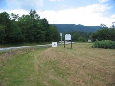
3. Fort Seybert Marker
Credits. This page was last revised on January 27, 2022. It was originally submitted on August 15, 2010, by Craig Swain of Leesburg, Virginia. This page has been viewed 3,011 times since then and 131 times this year. Photos: 1. submitted on August 15, 2010, by Craig Swain of Leesburg, Virginia. 2. submitted on November 25, 2011, by J. J. Prats of Powell, Ohio. 3. submitted on August 15, 2010, by Craig Swain of Leesburg, Virginia.
Editor’s want-list for this marker. Photo of the Fort Seybert cemetery enclosure. • Can you help?
