Stratford in Westmoreland County, Virginia — The American South (Mid-Atlantic)
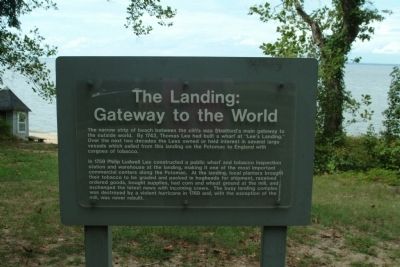
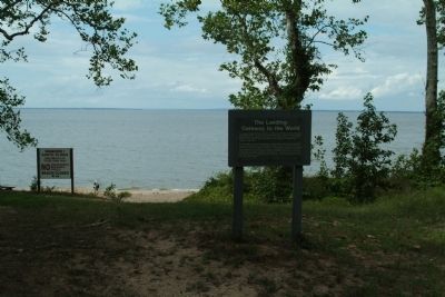
The Landing: Gateway to the World
In 1759 Philip Ludwell Lee constructed a public wharf and tobacco inspection station and warehouse at the landing, making it one of the most important commercial centers along the Potomac. At the landing, local planters brought their tobacco to be graded and packed in hogsheads for shipment, received ordered goods, bought supplies, had corn and wheat ground at the mill, and exchanged the latest news with incoming crews. The busy landing complex was destroyed by a violent hurricane in 1769 and, with the exception of the mill, was never rebuilt.
Topics. This historical marker is listed in these topic lists: Colonial Era • Waterways & Vessels. A significant historical year for this entry is 1743.
Location. 38° 9.776′ N, 76° 49.914′ W. Marker is in Stratford, Virginia, in Westmoreland County. Marker can be reached from Gate House Road, one mile north of Stratford Hall Road. The marker is on the grounds of Stratford Hall Plantation, the birthplace of Robert E. Lee. The historic site is on Stratford Hall Road (VA Highway 214), on the left when traveling east. The site is open to the public, for a fee. Touch for map. Marker is in this post office area: Stratford VA 22558, United States of America. Touch for directions.
Other nearby markers. At least 8 other markers are within walking distance of this marker. Stratford Landing: Significant Events (here, next to this marker); The Stratford Mill (within shouting distance of this marker); Controlling the Water Supply to the Mill (within shouting distance of this marker); The Stratford Cliffs (approx. ¼ mile away); Clifts Plantation Site (approx. 0.4 miles away); Clifts Plantation Burial Ground (approx. 0.4 miles away); American Indians at Stratford (approx. 0.8 miles away); Slave Cemetery (approx. 0.8 miles away). Touch for a list and map of all markers in Stratford.
Also see . . . Stratford Hall Historic Site. (Submitted on August 15, 2010, by Paul Jordan of Burlington, N. C., U. S. A..)
Additional keywords. Henry Lee, Robert E. Lee, Stratford Hall Plantation
Credits. This page was last revised on June 16, 2016. It was originally submitted on August 15, 2010, by Paul Jordan of Burlington, N. C., U. S. A.. This page has been viewed 611 times since then and 14 times this year. Photos: 1, 2, 3, 4. submitted on August 15, 2010, by Paul Jordan of Burlington, N. C., U. S. A.. • Bill Pfingsten was the editor who published this page.


