Appomattox in Appomattox County, Virginia — The American South (Mid-Atlantic)
The Last Fight
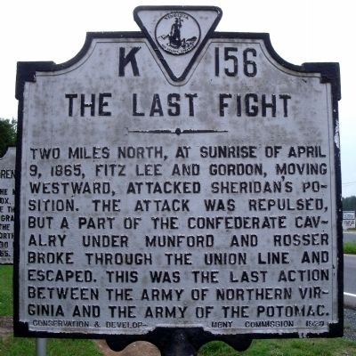
Photographed by Bernard Fisher, August 13, 2010
1. The Last Fight Marker
Erected 1929 by Conservation & Development Commission. (Marker Number K-156.)
Topics and series. This historical marker is listed in this topic list: War, US Civil. In addition, it is included in the Virginia Department of Historic Resources (DHR) series list. A significant historical date for this entry is April 9, 1930.
Location. 37° 21.661′ N, 78° 51.507′ W. Marker is in Appomattox, Virginia, in Appomattox County. It is on Richmond Highway (U.S. 460) 0.6 miles east of Police Tower Road (Virginia Route 613), on the right when traveling east. Touch for map. Marker is in this post office area: Appomattox VA 24522, United States of America. Touch for directions.

Regionally, this marker is in the Piedmont and in Central Virginia. It is also in the American South and specifically in the Upper
this page online
Other nearby markers. At least 8 other markers are within 2 miles of this marker, measured as the crow flies: Surrender at Appomattox (here, next to this marker); Robertson House Fight (approx. 0.9 miles away); a different marker also named Robertson House Fight (approx. 0.9 miles away); Eldon (approx. 1.2 miles away); The Last Positions (approx. 1.2 miles away); Carver-Price School (approx. 1.6 miles away); Winonah Camp / Mozella Price Home (approx. 1.6 miles away); Appomattox County Eternal Flame (approx. 1.6 miles away). Touch for a list and map of all markers in Appomattox.
Other markers no longer nearby. Carver-Price School (was approx. 1.6 miles away but has been replaced with another marker now near it); a different marker also named Winonah Camp / Mozella Price Home (was approx. 1.6 miles away but has been
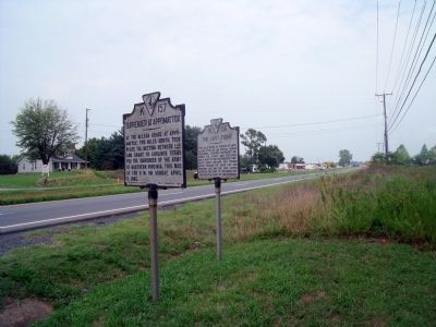
Photographed by Bernard Fisher, August 13, 2010
2. Richmond Hwy US Rt 460 (facing east)
Also see . . .
1. Appomattox Court House National Historical Park. National Park Service (Submitted on August 15, 2010, by Bernard Fisher of Richmond, Virginia.)
2. Appomattox Court House. CWSAC Battle Summary (Submitted on August 15, 2010, by Bernard Fisher of Richmond, Virginia.)
Credits. This page was last revised on July 25, 2018. It was originally submitted on August 15, 2010, by Bernard Fisher of Richmond, Virginia. This page has been viewed 1,233 times since then and 45 times this year. Photos: 1, 2. submitted on August 15, 2010, by Bernard Fisher of Richmond, Virginia.
