Near Eatonton in Putnam County, Georgia — The American South (South Atlantic)
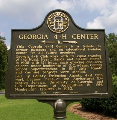
Georgia 4-H Center
<------<<<<
Georgia 4-H Club work, with its equal training of the Head, Heart, Hands and Health, started in 1905 with 151 boys, each growing one acre of corn, under leadership of G.C. Adams, County School Superintendent. In 1911 girls’ tomato and canning projects were started.
Led by County Extension Agents, 4-H Club work became part of the Agricultural Extension Service, University of Georgia, and U.S. Department of Agriculture in 1914. Membership 126,927 in 1953.
Erected 1954 by Georgia Historical Commission. (Marker Number 117-2.)
Topics and series. This historical marker is listed in these topic lists: Agriculture • Education. In addition, it is included in the Georgia Historical Society series list. A significant historical year for this entry is 1905.
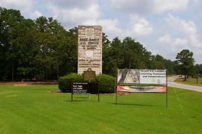
Location. 33° 25.055′ N, 83° 22.356′ W. Marker is near Eatonton, Georgia, in Putnam County. Marker is at the intersection of Madison Highway (U.S. 441) and Rock Eagle Road, on the right when traveling south on Madison Highway. The marker stands at the entrance to the Rock Eagle 4-H Center of the University of Georgia. Touch for map. Marker is in this post office area: Eatonton GA 31024, United States of America. Touch for directions.
Other nearby markers. At least 8 other markers are within 7 miles of this marker, measured as the crow flies. Rock Eagle Mound (within shouting distance of this marker); George Claud Adams (approx. 1.3 miles away); Georgia 4-H Clubs (approx. 1.7 miles away); Union Chapel United Methodist Church (approx. 1.9 miles away); Site of the Home and Private School of Adiel Sherwood (approx. 4.8 miles away); Springfield (approx. 6 miles away); Turnwold Plantation (approx. 6.1 miles away); Eatonton Presbyterian Church (approx. 6.2 miles away). Touch for a list and map of all markers in Eatonton.
Also see . . . Georgia 4 - H. Wikipedia has a comprehensive history of the Georgia 4-H. (Submitted on August 19, 2010.)
Credits. This page was last revised on June 16, 2016. It was originally submitted on August 17, 2010, by David Seibert of Sandy Springs, Georgia. This page has been viewed 897 times since then and 20 times this year. Photos: 1, 2. submitted on August 17, 2010, by David Seibert of Sandy Springs, Georgia. • Syd Whittle was the editor who published this page.

