
Solomons in Calvert County, Maryland — The American Northeast (Mid-Atlantic)
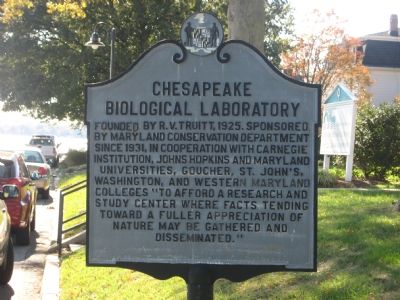
Chesapeake Biological Laboratory

Photographed by Rico Ramirez, October 24, 2024
1. Chesapeake Biological Laboratory Marker
Topics. This historical marker is listed in these topic lists: Education • Science & Medicine. A significant historical year for this entry is 1925.
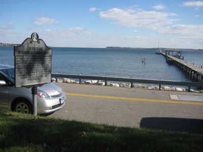
Location. 38° 19.093′ N, 76° 27.199′ W. Marker is in Solomons, Maryland, in Calvert County. It is on Farren Avenue 0.1 miles south of Charles Street (Maryland Route 2), on the right when traveling south. Marker is on the end of Solomons Island, just across the street from a long pier into the mouth of the Patuxent River. Touch for map. Marker is in this post office area: Solomons MD 20688, United States of America. Touch for directions.

Regionally, this marker is in Southern Maryland. It is also in the American South, specifically in the Upper South, in the Mid-Atlantic, in the Tidewater, in the Chesapeake Bay
this page online
Other nearby markers. At least 8 other markers are within walking distance of this marker: Beaven Hall (a few steps from this marker); a different marker also named Chesapeake Biological Laboratory (a few steps from this marker); a different marker also named Beaven Hall (within shouting distance of this marker); L. Eugene Cronin Laboratory (within shouting distance of this marker); a different marker also named L. Eugene Cronin Laboratory (within shouting distance of this marker); Cory Hall (within shouting distance of this marker); a different marker also named Chesapeake Biological Laboratory (within shouting distance of this marker); Nice Hall (within shouting distance of this marker). Touch for a list and map of all markers in Solomons.
Photographed by F. Robby, November 7, 2007
2. Chesapeake Biological Laboratory Marker

Photographed by F. Robby, November 7, 2007
3. Chesapeake Biological Laboratory
Photographed by F. Robby, November 7, 2007
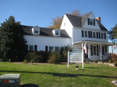
4. Solomons House
This house was the home of Isaac Solomon in 1865, from whom Solomons Island got its name. Portions of the building are dated from 1780. It is now the lab's visitor center, located at Charles Street and Farren Avenue.
Photographed by F. Robby, November 7, 2007
5. Patuxent River
View of the Patuxent River from the lawn of the Chesapeake Biological Laboratory.
Credits. This page was last revised on August 27, 2026. It was originally submitted on November 11, 2007, by F. Robby of Baltimore, Maryland. This page has been viewed 1,561 times since then and 24 times this year. Photos: 1. submitted on October 31, 2024, by Rico Ramirez of Prince Frederick, Maryland. 2, 3, 4, 5. submitted on November 11, 2007, by F. Robby of Baltimore, Maryland.
