Solomons in Calvert County, Maryland — The American Northeast (Mid-Atlantic)
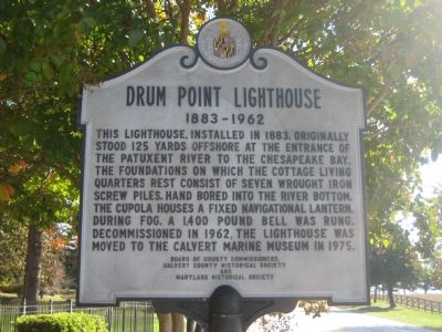
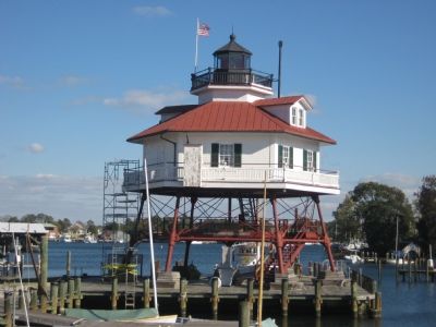
Drum Point Lighthouse
1883-1962
Erected by Board of County Commissioners, Calvert County Historical Society, Maryland Historical Society.
Topics and series. This historical marker is listed in these topic lists: Industry & Commerce • Waterways & Vessels. In addition, it is included in the Lighthouses series list. A significant historical year for this entry is 1883.
Location. 38° 19.839′ N, 76° 27.891′ W. Marker is in Solomons, Maryland, in Calvert County. Marker is on Solomons Island Road (Maryland Route 2) 0.1 miles south of Lore Road, on the left when traveling south. Marker is in front of the Calvert Marine Museum. Touch for map. Marker is in this post office area: Solomons MD 20688, United States of America. Touch for directions.
Other nearby markers. At least 8 other markers are within walking distance of this marker. The Ark of Hungerford Creek (within shouting distance of this marker); Volunteer (within shouting distance of this marker); Waterman's Shed (within shouting distance of this marker); Anchor (about 300 feet away, measured in a direct line); Built for Work — Built for Pleasure (about 400 feet away); Humphreys Rowing Skiff (about 400 feet away); Calvert County (about 400 feet away); Benning Crab Skiff (about 400 feet away). Touch for a list and map of all markers in Solomons.
Credits. This page was last revised on June 16, 2016. It was originally submitted on November 11, 2007, by F. Robby of Baltimore, Maryland. This page has been viewed 1,252 times since then and 18 times this year. Photos: 1, 2. submitted on November 11, 2007, by F. Robby of Baltimore, Maryland.

