Near Aladdin in Crook County, Wyoming — The American West (Mountains)
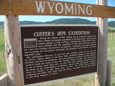
Custer's 1874 Expedition
The expedition's discovery of gold had wide reaching effects on the area and its future. Miners rushed to the Black Hills, ultimately helping to open northeast Wyoming Territory to settlement. The encroachment of settlers on Native American territory broke the terms of the Fort Laramie Treaty of 1868. The Sioux turned to war to defend their lands and, in June 1876, they defeated General Custer at the Battle of Little Bighorn in Montana. However, they surrendered to General Terry by October of that same year. In 1877, the United States officially confiscated the Black Hills lands from the Sioux, an action of which the legality is still being disputed in the courts.
Topics. This historical marker is listed in these topic lists: Exploration • Settlements & Settlers • Wars, US Indian. A significant historical month for this entry is June 1876.
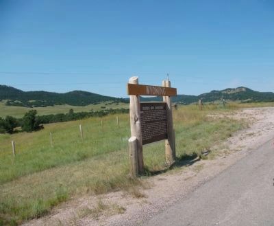
Location. 44° 39.357′ N, 104° 21.246′ W. Marker is near Aladdin, Wyoming, in Crook County. Marker is on State Highway 24, 0.2 miles west of Oak Creek Road, on the left when traveling west. Touch for map. Marker is in this post office area: Aladdin WY 82710, United States of America. Touch for directions.
Other nearby markers. At least 8 other markers are within 10 miles of this marker, measured as the crow flies. Devils Tower (approx. 7.1 miles away); Later Years of Operation (approx. 9˝ miles away); Tipple Stabilazation (sic) (approx. 9˝ miles away); Tipple Operation (approx. 9˝ miles away); Coal Production (approx. 9˝ miles away); Aladdin Tipple History (approx. 9˝ miles away); Adit Entrance (approx. 9˝ miles away); The Hoist House (approx. 9˝ miles away). Touch for a list and map of all markers in Aladdin.
Also see . . .
1. Its Equal I Have Never Seen: Custer Explores the Black Hills in 1874. an article by Dr. Brian W. Dippie from Columbia: The Magazine of Northwest History (Submitted on August 19, 2010, by William J. Toman of Green Lake, Wisconsin.)
2. U.S. vs. Sioux Nation. 1980 Supreme Court decision (Submitted on August 19, 2010, by William J. Toman of Green Lake, Wisconsin.)
Credits. This page was last revised on September 18, 2020. It was originally submitted on August 19, 2010, by William J. Toman of Green Lake, Wisconsin. This page has been viewed 2,294 times since then and 49 times this year. Photos: 1, 2. submitted on August 19, 2010, by William J. Toman of Green Lake, Wisconsin. • Syd Whittle was the editor who published this page.

