Solomons in Calvert County, Maryland — The American Northeast (Mid-Atlantic)
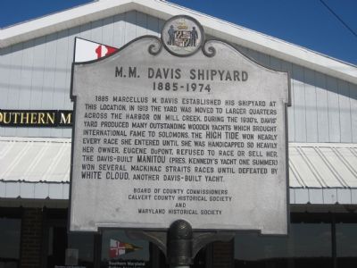
M. M. Davis Shipyard
1885–1974
Erected by Board of County Commissioners, Calvert County Historical Society, Maryland Historical Society.
Topics and series. This historical marker is listed in these topic lists: Industry & Commerce • Waterways & Vessels. In addition, it is included in the Former U.S. Presidents: #35 John F. Kennedy series list. A significant historical year for this entry is 1885.
Location. 38° 19.345′ N, 76° 27.58′ W. Marker is in Solomons, Maryland, in Calvert County. Marker is on Solomons Island Road (Maryland Route 2) 0.7 miles south of Lore Road, on the left when traveling south. Touch for map. Marker is in this post office area: Solomons MD 20688, United States of America. Touch for directions.
Other nearby markers. At least 8 other markers are within walking distance of this marker. J. C. Lore & Sons Oyster House (about 700 feet away, measured in a direct line); The Chesapeake Bay Bugeye (about 700 feet away); Mansueti Laboratory (approx. 0.4 miles away); Saunders House (approx. 0.4 miles away); Becker House (approx. 0.4 miles away); Solomon's Island (approx. 0.4 miles away); Parish House (approx. 0.4 miles away); Solomons House & Visitor Center (approx. 0.4 miles away). Touch for a list and map of all markers in Solomons.
Credits. This page was last revised on June 16, 2016. It was originally submitted on November 11, 2007, by F. Robby of Baltimore, Maryland. This page has been viewed 1,909 times since then and 38 times this year. Photo 1. submitted on November 11, 2007, by F. Robby of Baltimore, Maryland.
