St. Marys in Pottawatomie County, Kansas — The American Midwest (Upper Plains)
Site of the Oregon Trail
1830 - 1876
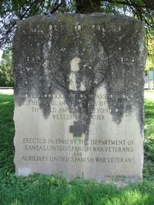
Photographed by Lee Hattabaugh, July 1, 2010
1. Site of the Oregon Trail Marker
Erected 1940 by The Department of Kansas, United Spanish War Veterans and Auxiliary United Spanish War Veterans.
Topics and series. This historical marker is listed in these topic lists: Roads & Vehicles • Settlements & Settlers • War, Spanish-American. In addition, it is included in the Oregon Trail series list.
Location. 39° 11.45′ N, 96° 3.683′ W. Marker is in St. Marys, Kansas, in Pottawatomie County. It is on East Bertrand Street (U.S. 24) west of Grand Avenue, on the right when traveling west. Touch for map. Marker is in this post office area: Saint Marys KS 66536, United States of America. Touch for directions.

Regionally, this marker is in Eastern Kansas and specifically in Bleeding Kansas Border War Country. It is also in the American Midwest, in the Corn Belt, on the prairies, and on the Southern Plains. Globally, it is in North America, the Western Hemisphere, the Western World, and the Anglosphere. Historically,
this page online
Other nearby markers. At least 8 other markers are within 7 miles of this marker, measured as the crow flies: St. Marys (about 400 feet away, measured in a direct line); The Great Military Road (about 400 feet away); Indian Pay Station Museum (about 500 feet away); St. Marys Vietnam Memorial (approx. 0.6 miles away); Potawatomi Pay Station & St. Marys Mission (approx. 0.6 miles away); Old Fire and Curfew Bell (approx. 0.6 miles away); a different marker also named Great Military Road (approx. 5.6 miles away); Veterans Memorial (approx. 6.9 miles away). Touch for a list and map of all markers in St. Marys.
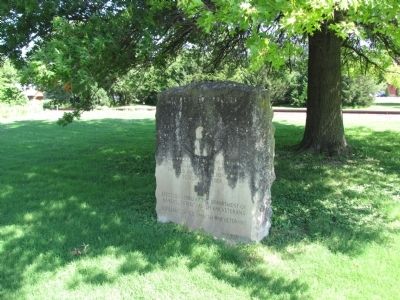
Photographed by Lee Hattabaugh, July 1, 2010
2. Site of the Oregon Trail Marker
Monument made by Quiring Monument Co. Wichita, KS, as indicated by engraving on lower front of the monument.
Credits. This page was last revised on June 16, 2016. It was originally submitted on August 23, 2010, by Lee Hattabaugh of Capshaw, Alabama. This page has been viewed 1,464 times since then and 64 times this year. Photos: 1, 2. submitted on August 23, 2010, by Lee Hattabaugh of Capshaw, Alabama. • Bill Pfingsten was the editor who published this page.
