Near Cañon City in Fremont County, Colorado — The American Mountains (Southwest)
Royal Gorge
Photographed by Michael Stroud, May 30, 1994
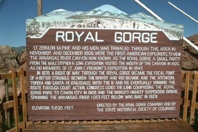
1. Royal Gorge
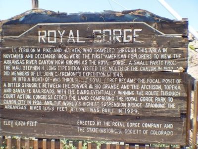
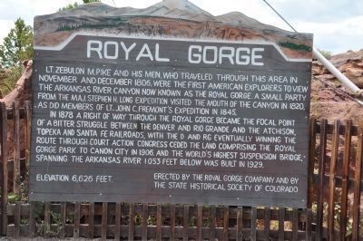
Lt. Zubulon M. Pike and his men, who traveled through this area in November and December 1806, were the first American explorers to view the Arkansas River Canyon now known as the Royal Gorge. A small party from the Maj. Stephen H. Long expedition visited the mouth of the canyon in 1820, as did members of Lt. John C. Fremont's expedition in 1845.
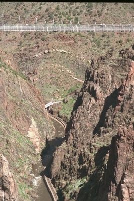
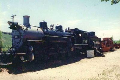
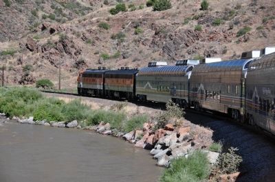
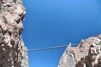
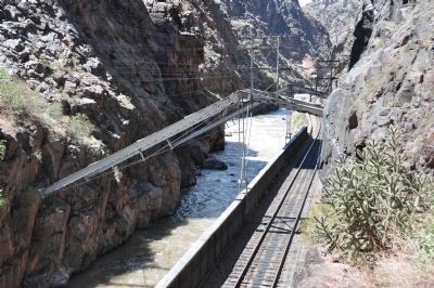
In 1878 a right of way through Royal Gorge became the focal point of a bitter struggle between The Denver and Rio Grande and the Atchison, Topeka and Santa Fe Railroads, with the D and RG winning the route through court action. Congress ceded the land comprising the Royal Gorge Park to Canon City in 1906. And the world's highest suspension bridge, spanning the Arkansas River 1053 feet below was built in 1929.
Elevation 6,626 feet
Erected 1967 by Royal Gorge Company and by the State Historical Society of Colorado. (Marker Number 141.)
Topics and series. This historical marker is listed in these topic lists: Bridges & Viaducts • Exploration • Natural Features • Railroads & Streetcars. In addition, it is included in the Atchison, Topeka and Santa Fe Railway,
this page online
Location. 38° 27.771′ N, 105° 19.412′ W. Marker is near Cañon City, Colorado, in Fremont County. It is on County Road 3A 4½ miles south of U.S. 24, on the right when traveling south. Marker is located at Royal Gorge Bridge and Park, about 7 1/4 miles west of Canon City. Touch for map. Marker is at or near this postal address: 4218 County Road 3A, Canon City CO 81212, United States of America. Touch for directions.

Regionally, this marker is in the Arkansas River Valley and in Pikes Peak Region. It is also in the American Mountain West. Globally, it is in North America, the Rocky Mountains, the Western Hemisphere, the Western World, and the Anglosphere. Historically, it finds itself in what was once the Comanchería and also the Republic of Texas.
Other nearby markers. At least 8 other markers are within 5 miles of this marker, measured as the crow flies: How the Bridge Became Royal (within shouting distance of this marker); Royal Gorge Bridge (about 700 feet away, measured in a direct line); Zebulon Pike Block House (approx. 3.8 miles away);
Photographed by Mike Stroud, May 30, 1994
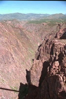
2. Royal Gorge
Also see . . .
1. The City of Cañon City - Official Website. (Submitted on December 20, 2007, by Mike Stroud of Bluffton, South Carolina.)
2. Royal Gorge War. (Submitted on December 20, 2007, by Mike Stroud of Bluffton, South Carolina.)
3. Royal Gorge Bridge and Park Website. (Submitted on December 21, 2007, by Kevin W. of Stafford, Virginia.)
4. Wikipedia entry for Royal Gorge. (Submitted on December 20, 2007, by Mike Stroud of Bluffton, South Carolina.)
Additional commentary.
1. Native Americans of the Ute People
Before European settlement, Native Americans of the Ute people wintered in Royal Gorge for its protection from wind and relatively mild climate. The Comanche, Kiowa, Sioux, and Cheyenne used Royal Gorge on buffalo hunting expeditions as an access point to mountain meadow regions such as South Park Basin. Colorado's Rocky Mountain region fell under Spanish claims, and conquistador expeditions of the 17th century or fur traders may have seen Royal Gorge while traversing the area. The first recorded instance of a European arrival, however, is the Pike expedition of 1806. Zebulon Pike's group built a crude shelter in the gorge and explored the area, descending on horseback over the frozen Arkansas River.
— Submitted December 20, 2007, by Mike Stroud of Bluffton, South Carolina.
2. The City of Cañon City
The Royal Gorge Bridge, owned by the City, is one of the major attractions located
Photographed by Mike Stroud, May 30, 1994
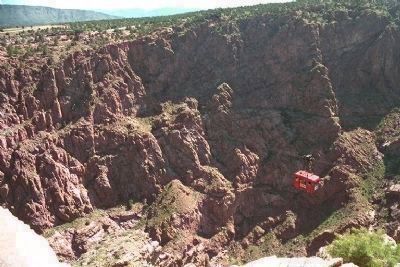
3. Royal Gorge Tram
— Submitted December 20, 2007, by Mike Stroud of Bluffton, South Carolina.
Photographed by Mike Stroud, May 30, 1994
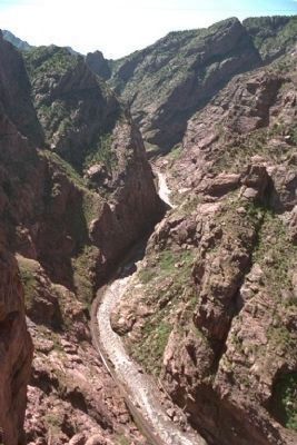
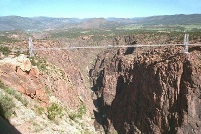
4. Royal Gorge, Arkansas River
Photographed by Michael Stroud, May 30, 1994
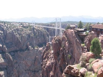
5. Bridge over the Royal Gorge
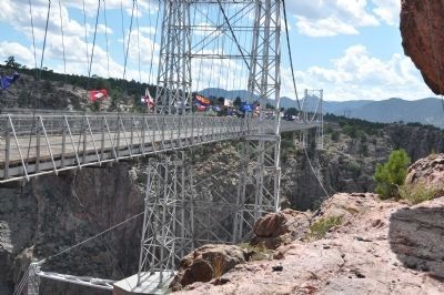
The Colorado Royal Gorge Bridge is listed in the Register of Historic Places. Constructed in November 1929 as a one-lane toll bridge, it has a wooden walkway consisting of over 1000 planks. Suspended from 150 foot tall towers, it is 880 feet long and 18 feet wide.
Photographed by Michael Stroud, May 30, 1994
6. Arkansas River with Denver and Rio Grande RR track alongside
Photographed by Michael Stroud, circa June 1994
7. The Railroad that won the court battle
Photographed by Bryan R. Bauer, August 6, 2010
8. And today's excursion trains travel the route that was won
Photographed by Bryan R. Bauer, August 6, 2010
9. View of the bridge from the bottom of the gorge
Photographed by Bryan R. Bauer, August 6, 2010
10. The historic hanging bridge
Photographed by Bryan R. Bauer, August 6, 2010
11. Sightseeing helicopters above (and excursion trains below)
Photographed by Bryan R. Bauer, August 6, 2010
12. The bridge with the 50 State flags
Photographed by Bryan R. Bauer, August 6, 2010
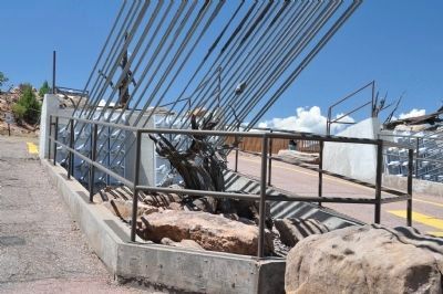
13. ... And The South End Cable Anchors
Photographed by Janet K. Bonner, July 19, 2005
14. Eleven years later ... the same sign?
Photographed by Robert L Weber
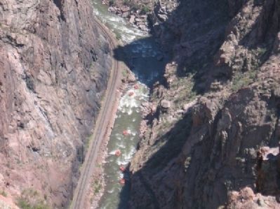
15. Royal Gorge Rafters
Photographed by Robert L Weber, July 15, 2006
16. Royal Gorge Bridge
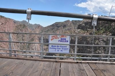
Photographed by Bryan R. Bauer, August 6, 2010
17. And 5 years after that ... back to its original glory
Photographed by Bryan R. Bauer, August 6, 2010
18. An "historic" event for the bridge
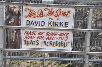
Photographed by Bryan R. Bauer, August 6, 2010
19. ... And Yet Another
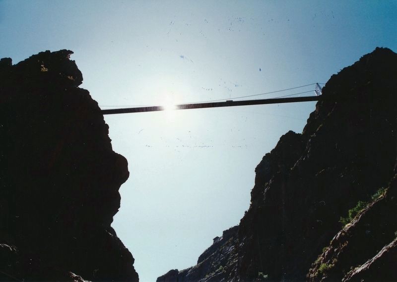
Photographed by Garrett Koch, August 23, 1993
20. Royal Gorge bridge, view from underneath, standing next to Arkansas River
Credits. This page was last revised on July 19, 2026. It was originally submitted on December 20, 2007, by Mike Stroud of Bluffton, South Carolina. This page has been viewed 4,535 times since then and 58 times this year. Last updated on August 25, 2010, by Bryan R. Bauer of Kearns, Ut 84118. Photos: 1. submitted on December 20, 2007, by Mike Stroud of Bluffton, South Carolina. 2, 3, 4. submitted on April 10, 2010, by Mike Stroud of Bluffton, South Carolina. 5, 6, 7. submitted on December 20, 2007, by Mike Stroud of Bluffton, South Carolina. 8, 9, 10, 11, 12, 13. submitted on August 25, 2010, by Bryan R. Bauer of Kearns, Ut 84118. 14. submitted on December 21, 2007, by Kevin W. of Stafford, Virginia. 15. submitted on December 17, 2010, by Bob (peach) Weber of Dewey, Arizona. 16. submitted on December 27, 2010, by Bob (peach) Weber of Dewey, Arizona. 17, 18, 19. submitted on August 24, 2010, by Bryan R. Bauer of Kearns, Ut 84118. 20. submitted on July 19, 2026, by Garrett Koch of Saint Louis, Missouri. • Kevin W. was the editor who published this page.
