South Thimble Island in Virginia Beach, Virginia — The American South (Mid-Atlantic)
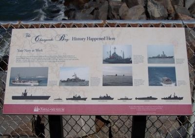
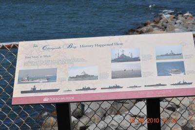
The Chesapeake Bay : History Happened Here
Your Navy at Work
Photographed by Mike Stroud, October 16, 2010
1. The Chesapeake Bay : History Happened Here Your Navy at Work Marker
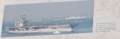
Sailors aboard Nimitz~class aircraft carried USS Harry S. Truman (CVN 75) man the rails as the ship transits the Chesapeake Bay.
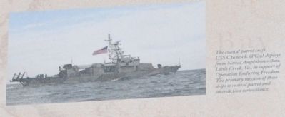
The coastal patrol craft USS Chinook (PG 9) deploys from Naval Amphibious Base, Little Creek, VA., in support of Operations Enduring Freedom. The primary mission of these ships is coastal patrol and interdiction surveillance.
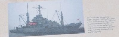
The rescue and salvage ship USS Grapple (ARS 53) endures a rare snow storm on board Naval Amphibious Base (NAB) Little Creek, Va. Rescue and salvage ships render assistance to disabled ships including towing, diving and firefighting.
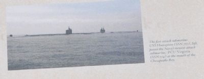
The fast attack submarine USS Hampton (SSN 767), left, passes the Navy's newest attack submarine, PCU Virginia (SSN 774)
this page online
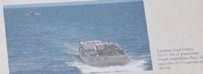
Landing Craft Utility (LCU 1664) from Little Creek Amphibious Base, Va., and other LCUs operate in the bay.
Aircraft Carrier, Coastal Patrol Boat, Cruisers, Dock Landing Ships, Frigate, Submarine, Guided Missile Destroyer.
Erected by Hampton Roads Naval Museum Local History World Events.
Topics. This historical marker is listed in these topic lists: Military • Waterways & Vessels.
Location. 36° 57.999′ N, 76° 6.753′ W. Marker is in Virginia Beach, Virginia. It is on South Thimble Island. It is on Chesapeake Bay Bridge Tunnel (U.S. 13), on the right when traveling north. Touch for map. Marker is in this post office area: Virginia Beach VA 23455, United States of America. Touch for directions.

Regionally, this marker is in Virginia’s Hampton Roads, specifically in Coastal Virginia, and in the Hampton Roads Metropolitan Area. It is also in the American South, specifically in the Upper South, in the Tidewater,
Photographed by Sandra Hughes, August 15, 2010
2. The Chesapeake Bay : History Happened Here Marker
Other nearby markers. At least 8 other markers are within 5 miles of this marker, measured as the crow flies: Lucius J. Kellam, Jr. (here, next to this marker); The Chesapeake Bay: History Happened Here (a few steps from this marker); Tribute to Admiral de Grasse (a few steps from this marker); a different marker also named The Chesapeake Bay : History Happened Here (within shouting distance of this marker); a different marker also named The Chesapeake Bay : History Happened Here (within shouting distance of this marker); a different marker also named The Chesapeake Bay: History Happened Here (within shouting distance of this marker); Protecting Our Waterways and Wildlife (approx. 4.1 miles away); The Canoes, 2018 (approx. 4.2 miles away). Touch for a list and map of all markers
Photographed by Sandra Hughes, August 15, 2010
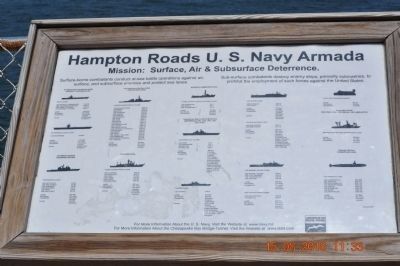
3. Hampton Roads U.S. Navy Armada
Photographed by Sandra Hughes, August 15, 2010
4. USS Harry S. Truman
Photographed by Sandra Hughes, August 15, 2010
5. USS Chinook
Photographed by Sandra Hughes, August 15, 2010
6. USS Grapple
Photographed by Sandra Hughes, August 15, 2010
7. USS Hampton
Photographed by Sandra Hughes, August 15, 2010
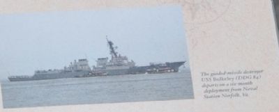
8. USS Bukeley
Photographed by Sandra Hughes, August 15, 2010
9. Landing Craft Utility
Credits. This page was last revised on February 1, 2023. It was originally submitted on August 25, 2010, by Sandra Hughes Tidwell of Killen, Alabama, USA. This page has been viewed 1,006 times since then and 45 times this year. Photos: 1. submitted on October 24, 2010, by Mike Stroud of Bluffton, South Carolina. 2, 3, 4, 5, 6, 7, 8, 9. submitted on August 25, 2010, by Sandra Hughes Tidwell of Killen, Alabama, USA. • Bill Pfingsten was the editor who published this page.
