Norcross in Gwinnett County, Georgia — The American South (South Atlantic)
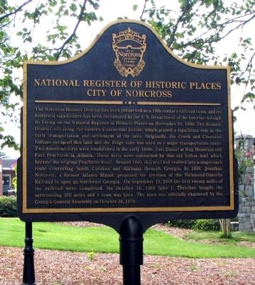
National Register of Historic Places – City of Norcross
Inscription.
The Norcross Historic District has been preserved as a 19th century railroad town, and its historical significance has been recognized by the U. S. Department of the Interior through its listing on the National Register of Historic Places on November 21, 1980. The Historic District sits along the eastern Continental Divide, which played a significant role in the early transportation and settlement of the area. Originally, the Creek and Cherokee Indians occupied this land and the Ridge Line was used as a major transportation route. Two American forts were established in the early 1800s: Fort Daniel at Hog Mountain and Fort Peachtree in Atlanta. These forts were connected by this old Indian trail which became the original Peachtree Road. Around 1840, this trail had evolved into a stagecoach route connecting South Carolina and Alabama through Georgia. In 1856, Jonathan Norcross, a former Atlanta Mayor, proposed the creation of the Richmond-Danville Railroad to open up Northeast Georgia. On September 12, 1869 John J. Thrasher bought the surrounding 250 acres and a town was born. The town was officially chartered by the Georgia General Assembly on October 26, 1870.
Erected by City of Norcross, Gwinnett County, Georgia.
Topics. This historical marker is listed in these topic lists: Forts and Castles • Native Americans • Roads & Vehicles • Settlements & Settlers. A significant historical date for this entry is September 12, 1869.
Location. 33° 56.537′ N, 84° 12.712′ W. Marker is in Norcross, Georgia, in Gwinnett County. Marker is on Lawrenceville Street NW, 0 miles north of Jones Street NW, on the left when traveling north. The marker stands in front of the Norcross City Hall. Touch for map. Marker is at or near this postal address: 40 Lawrenceville Street NW, Norcross GA 30071, United States of America. Touch for directions.
Other nearby markers. At least 8 other markers are within walking distance of this marker. American Elm (within shouting distance of this marker); Site of Norcross Presbyterian Church (within shouting distance of this marker); The Ball Ground (within shouting distance of this marker); Lillian Hicks Webb (within shouting distance of this marker); 29 Jones Street (about 300 feet away, measured in a direct line); "Checkers Alley" (about 300 feet away); 9 South Peachtree Street (about 300 feet away); 15 South Peachtree Street (about 300 feet away). Touch for a list and map of all markers in Norcross.
Credits. This page was last revised on November 27, 2020. It was originally submitted on August 29, 2010, by David Seibert of Sandy Springs, Georgia. This page has been viewed 1,347 times since then and 48 times this year. Photo 1. submitted on August 29, 2010, by David Seibert of Sandy Springs, Georgia. • Craig Swain was the editor who published this page.
