Severn in Anne Arundel County, Maryland — The American Northeast (Mid-Atlantic)
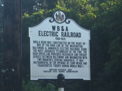
W B & A Electric Railroad
1908-1935
Erected by Maryland Historical Trust, Maryland State Highway Administration.
Topics and series. This historical marker is listed in these topic lists: Industry & Commerce • Railroads & Streetcars • Roads & Vehicles • War, World I. In addition, it is included in the Maryland Historical Trust series list.
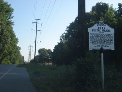
Location. 39° 8.088′ N, 76° 40.35′ W. Marker is in Severn, Maryland, in Anne Arundel County. Marker is at the intersection of WB&A Road and Donaldson Avenue (Maryland Route 174), on the right when traveling north on WB&A Road. Touch for map. Marker is at or near this postal address: 640 Donaldson Ave, Severn MD 21144, United States of America. Touch for directions.
Other nearby markers. At least 8 other markers are within 4 miles of this marker, measured as the crow flies. Queenstown Rosenwald School (approx. 1.3 miles away); Wesley Grove United Methodist Church (approx. 2˝ miles away); Harmans (approx. 3 miles away); St. Alban's Episcopal Church (approx. 3.1 miles away); World War 1917 (approx. 3.2 miles away); Recreation Acres (approx. 3.2 miles away); Defending the Chesapeake Bay (approx. 3.2 miles away); World War II (approx. 3.2 miles away).
Credits. This page was last revised on April 3, 2023. It was originally submitted on August 29, 2010, by F. Robby of Baltimore, Maryland. This page has been viewed 1,633 times since then and 74 times this year. Photos: 1, 2. submitted on August 29, 2010, by F. Robby of Baltimore, Maryland.

