Near Fredericksburg in Spotsylvania County, Virginia — The American South (Mid-Atlantic)
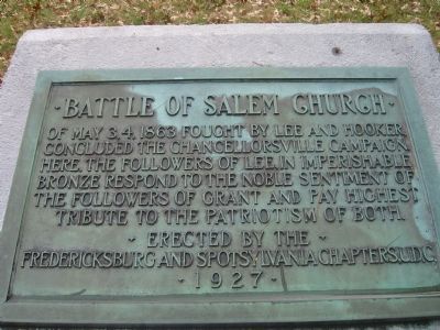
Battle of Salem Church
Photographed by Kevin W., November 10, 2007
1. Battle of Salem Church Marker
Erected by the
Fredericksburg and Spotsylvania Chapters, U.D.C.
1927
Erected by Fredericksburg and Spotsylvania Chapters, U.D.C.
Topics and series. This historical marker is listed in these topic lists: Military • War, US Civil. In addition, it is included in the Battlefield Markers Association, and the United Daughters of the Confederacy series lists. A significant historical date for this entry is May 3, 1844.
Location. 38° 17.346′ N, 77° 31.873′ W. Marker is near Fredericksburg, Virginia, in Spotsylvania County. It can be reached from Old Salem Church Road near Plank Road (Virginia Route 3). Touch for map. Marker is at or near this postal address: 4044 Plank Road, Fredericksburg VA 22407, United States of America. Touch for directions.

Regionally, this marker is in the Washington Metropolitan Area, in Northern Virginia, and in the Piedmont. It is also in the American South,
this page online
Other nearby markers. At least 8 other markers are within walking distance of this marker: A different marker also named The Battle of Salem Church (here, next to this marker); From Church to Hospital (here, next to this marker); a different marker also named Battle of Salem Church (a few steps from this marker); Refuge from Horror (within shouting distance of this marker); Old Salem Church (within shouting distance of this marker); Salem Church (within shouting distance of this marker); Churchyard to Battleground (about 300 feet away, measured in a direct line); Sanctuaries in Spotsylvania (about 300 feet away). Touch for a list and map of all markers in Fredericksburg.
Regarding Battle of Salem Church. This is one
Photographed by Kevin W., November 10, 2007
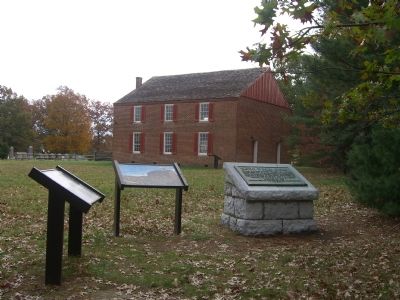
2. Battle of Salem Church and two related markers
Also see . . .
1. Salem Church Virtual Tour by Markers. The Salem Church site, surrounded by modern development, was an important site in the later stages of the Battle and Campaign of Chancellorsville. (Submitted on November 12, 2007, by Craig Swain of Leesburg, Virginia.)
2. Salem Church Walking Trail. National Park Service guide. (Submitted on November 12, 2007, by Craig Swain of Leesburg, Virginia.)
Photographed by Craig Swain, November 10, 2007
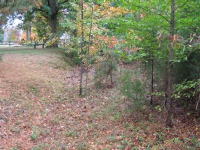
3. Portions of the Old Salem Church Road
The Confederate battle line was oriented on this road, running generally north-south here.
Photographed by Bernard Fisher, April 29, 2006
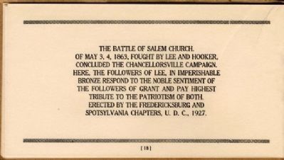
4. Battlefield Markers Association, Western Division (1929)
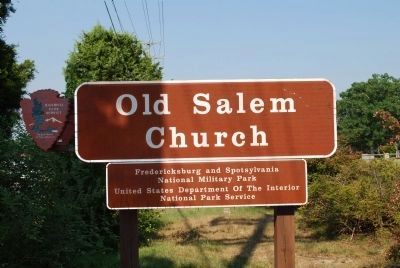
Photographed by Brandon Fletcher, July 18, 2008
5. Old Salem Church
Credits. This page was last revised on April 25, 2023. It was originally submitted on November 12, 2007, by Kevin W. of Stafford, Virginia. This page has been viewed 2,185 times since then and 49 times this year. Photos: 1, 2. submitted on November 12, 2007, by Kevin W. of Stafford, Virginia. 3. submitted on November 12, 2007, by Craig Swain of Leesburg, Virginia. 4. submitted on December 9, 2008, by Bernard Fisher of Richmond, Virginia. 5. submitted on July 25, 2015, by Brandon Fletcher of Chattanooga, Tennessee.
