Near Corbettsville in Broome County, New York — The American Northeast (Mid-Atlantic)
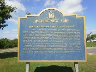
Binghamton and Upper Susquehanna
Historic New York
Many settlers of the Southern Tier counties of New York came from Pennsylvania. A Philadelphia merchant and landholder, William Bingham, gave his name to the city of Binghamton. In 1837 the Chenango canal connected the Erie Canal with the Pennsylvania coal regions, and in 1848 the Erie Railroad opened communication with metropolitan New York, and later through to the Great Lakes. Important manufactures have included cigars, shoes, leather goods, photographic materials and business machines.
Erected 1961 by State of New York, Education Department, Department of Public Works.
Topics and series. This historical marker is listed in these topic lists: Industry & Commerce • Native Americans • Settlements & Settlers • War, US Revolutionary. In addition, it is included in the Chenango Canal, and the Historic New York State series lists. A significant historical year for this entry is 1779.
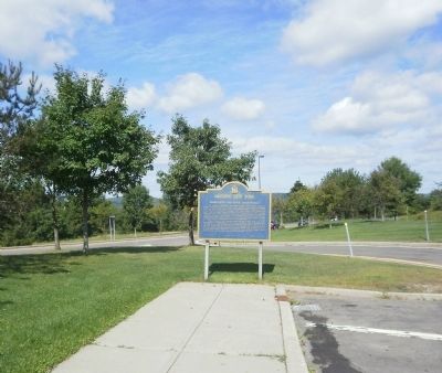
Location. 42° 1.214′ N, 75° 46.8′ W. Marker is near Corbettsville, New York, in Broome County. Marker can be reached from Interstate 81 at milepost 1. Marker is located at the New York Welcome Center (Northbound), 5 miles north of Hallstead, Pennsylvania. Touch for map. Marker is in this post office area: Corbettsville NY 13749, United States of America. Touch for directions.
Other nearby markers. At least 8 other markers are within 9 miles of this marker, measured as the crow flies. Pennsylvania (approx. 2.3 miles away in Pennsylvania); War Memorial (approx. 3 miles away in Pennsylvania); Citizen Soldiers from Bravo Company, First Battalion, One Hundred and Ninth Mechanized Infantry (approx. 3 miles away in Pennsylvania); "Lokies" boost coal production ... (approx. 3 miles away in Pennsylvania); Joseph Smith (approx. 4.3 miles away in Pennsylvania); 19th Century Hawleyton (approx. 7 miles away); New York State Inebriate Asylum (approx. 7.4 miles away); Windsor (approx. 8.2 miles away).
Credits. This page was last revised on June 16, 2016. It was originally submitted on September 1, 2010, by Deb Hartshorn of Burlington County, New Jersey. This page has been viewed 1,487 times since then and 31 times this year. Photos: 1, 2. submitted on September 1, 2010, by Deb Hartshorn of Burlington County, New Jersey. • Syd Whittle was the editor who published this page.

