Brookline near Battlefield in Greene County, Missouri — The American Midwest (Upper Plains)
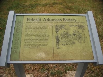
Pulaski Arkansas Battery
Wilson's Creek
Despite the casualties, Captain William E. Woodruff believed his battery had a very successful day of gunning. Woodruff wrote, "Our fire was ... directed where it could be advantageously used without injury to our own troops, sometimes at the opposing battery, at others against the assaults of the enemy on the hill to the northwest..."
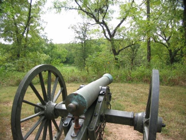
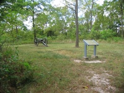
The guns in place here today are aimed toward the site of the opposing batteries on "Bloody Hill."
Topics. This historical marker is listed in this topic list: War, US Civil.
Location. 37° 6.217′ N, 93° 24.343′ W. Marker is near Battlefield, Missouri, in Greene County. It is in Brookline. Marker can be reached from Tour Road, on the right when traveling south. Located along a short trail from stop 3, the East Battlefield Overlook, of the Wilson's Creek battlefield driving tour. Touch for map. Marker is in this post office area: Brookline MO 65619, United States of America. Touch for directions.
Other nearby markers. At least 8 other markers are within walking distance of this marker. A different marker also named Pulaski Arkansas Battery (approx. 0.2 miles away); Price's Headquarters (approx. 0.2 miles away); A Union Plan / The Broken Pincer (approx. ¼ mile away); The Eye of the Storm (approx. ¼ mile away); Death of Brigadier General Nathaniel Lyon (approx. 0.3 miles away); Fight in Ray's Cornfield (approx. half a mile away); The Ray Family (approx. half a mile away); Ray Springhouse (approx. half a mile away). Touch for a list and map of all markers in Battlefield.
Also see . . . Wilson's Creek National Battlefield Park. (Submitted on September 2, 2010, by Craig Swain of Leesburg, Virginia.)

Photographed By Craig Swain, August 29, 2010
3. View of Bloody Hill from the Gun
The cannon is a James Type 1 Rifled gun which fired a 3.8-inch projectile. This piece was made by Miles Greenwood & Company of Cincinnati, Ohio, in 1861. It has 15 groove rifling and weighed 856 pounds when produced. Greenwood used the exterior form of the Model 1841 6-pdr smoothbore gun.
Credits. This page was last revised on February 16, 2023. It was originally submitted on September 2, 2010, by Craig Swain of Leesburg, Virginia. This page has been viewed 832 times since then and 16 times this year. Photos: 1, 2, 3. submitted on September 2, 2010, by Craig Swain of Leesburg, Virginia.

