Shawnee Springs near Springfield in Clark County, Ohio — The American Midwest (Great Lakes)
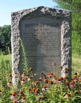
Battle of Piqua
August 8, 1780
Within this park and immediate vicinity, former site of the Shawnee Indian Village of Piqua. The Shawnees and their British Allies were defeated by General George Rogers Clark with his army of Kentucky Frontiersmen. This battle greatly advanced the cause of the American Revolution on the Western Front.
Erected 1953 by Ohio Revolutionary Memorial Commission.
Topics and series. This historical marker is listed in these topic lists: Native Americans • War, US Revolutionary. In addition, it is included in the Ohio Revolutionary Memorial Commission series list.
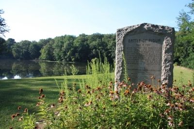
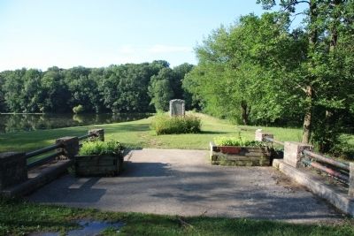
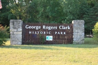
Location. 39° 54.721′ N, 83° 54.242′ W. Marker is near Springfield, Ohio, in Clark County. It is in Shawnee Springs. Marker is on Tecumseh Road (Ohio Route 369) north of Lower Valley Pike. This historical marker is located in George Rogers Clark Historical Park, just north of a parking area, that is located at the southeast end of a small lake. The historical marker was erected on the earthen dam that was built to create the small lake and is situated near the southeast end of the dam, very near the parking area. Touch for map. Marker is in this post office area: Springfield OH 45506, United States of America. Touch for directions.
Other nearby markers. At least 8 other markers are within 2 miles of this marker, measured as the crow flies. Tecumseh (approx. ¼ mile away); The Battle of Piqua, or Picawey (approx. 0.4 miles away); The Keifer Cabin Site (approx. 0.4 miles away); Peckuwe Shawnee Memorial (approx. half a mile away); a different marker also named The Battle of Piqua (approx. half a mile away); General George Rogers Clark / Tecumseh (approx. half a mile away); In Memory of Those Men Who Died in the Battle of Piqua (approx. half a mile away); Vale Veterans Memorial (approx. 2 miles away). Touch for a list and map of all markers in Springfield.
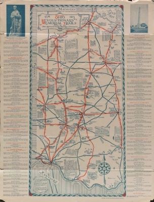
More about this marker. This historical marker was erected here as part of the work of the Ohio Revolutionary Memorial Commission. This commission was formed with the intent to commemorate in 1930, the sesquicentennial anniversary of the Revolutionary War era, Battle of Piqua, which was fought in 1780. In addition to erecting this historical monument (in 1953), the Ohio Revolutionary Memorial Commission was also responsible for the creation of the George Rogers Clark Historical Park, holding a sesquicentennial reenactment of the battle, and creating Ohio’s portion of a tri-state (Kentucky, Ohio, and Michigan) roadway system of historical trails,
entitled the Ohio Revolutionary Memorial Trails (see related link #4).
Regarding Battle of Piqua. In the document, “Chronology of history of George Rogers Clark Park” (see related link #5), it states that in 1929: “Governor Donohay appoints members of the George Rogers Clark Memorial Commission, formed statewide consisting of many local and state dignitaries. They are to investigate possibilities of commemorating the 150th anniversary of the Battle of Picawey and the Northwest Ordinance. Their recommendations include:
1. The creation of an Ohio Revolutionary Memorial at the site with a tri-state trail system (see related link #4).
2. A major State park at the site of the Battle:
“… that the site of the Battle of Piqua be acquired by the State as a permanent park, and that a permanent building be erected, preferably a replica of the pioneer type of fort, one such having stood upon this battlefield as a defense for the Indian town of Piqua… and that there be prepared therein, or in another structure adjacent, a museum pertaining to Indian, frontier and pioneer days.”
Later in 1929: “The Ohio Revolutionary Memorial Commission is formed,” appointed pursuant to the Act of the General Assembly, passed April 6, 1929, and approved by Governor Myers T Cooper, April 25, 1929, and filed with the Secretary of State
April 26, 1929 (Amended State Bill Number 91 by Senator M. S. Kuhns) entitled 'An Act to provide for the creation of an Ohio Revolutionary Memorial Commission; defining its powers and duties and making an appropriation for the work of the Commission.' "
Then, for 1930, the document states: “Land is purchased by the Revolutionary Commission from Wylie E. Potts (the net amount of land being 201.205 acres) with the State paying the purchase price of $21,126.52, thus creating George Rogers Clark Memorial Park…."
So it was this Ohio Revolutionary Memorial Commission that was responsible for the creation of George Rogers Clark Historical Park and for the erection of this historical marker.
Also see . . .
1. The Battle of Piqua. Ohio History Central. website entry (Submitted on September 4, 2010, by Dale K. Benington of Toledo, Ohio.)
2. Battle of Piqua. Touring Ohio website entry (Submitted on September 4, 2010, by Dale K. Benington of Toledo, Ohio.)
3. Battle of Piqua. Wikipedia entry (Submitted on September 4, 2010, by Dale K. Benington of Toledo, Ohio.)
4. Ohio Revolutionary Memorial Trail System. This is a link to information provided by a web site that is hosted by rootsweb. (Submitted on September 4, 2010, by Dale K. Benington of Toledo, Ohio.)
5. George Rogers Clark Park. This is a link to information provided by
the Clark County Park District. (Submitted on September 4, 2010, by Dale K. Benington of Toledo, Ohio.)
Credits. This page was last revised on February 7, 2023. It was originally submitted on September 4, 2010, by Dale K. Benington of Toledo, Ohio. This page has been viewed 3,450 times since then and 50 times this year. Photos: 1, 2, 3, 4. submitted on September 5, 2010, by Dale K. Benington of Toledo, Ohio. 5. submitted on September 8, 2014, by Dale K. Benington of Toledo, Ohio.
