Prairie Grove in Washington County, Arkansas — The American South (West South Central)
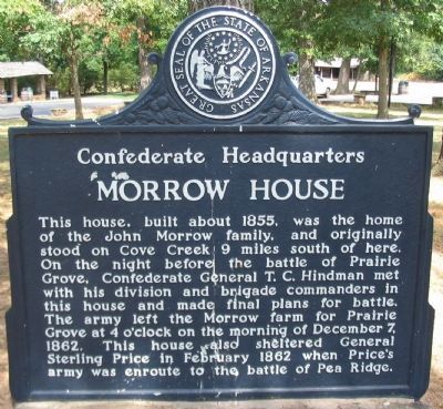
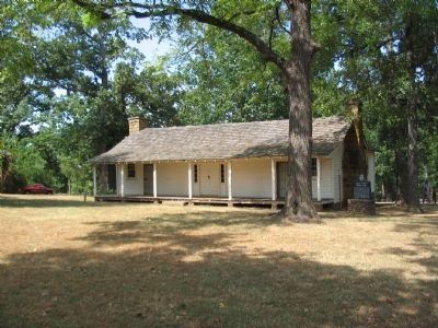
Morrow House
Confederate Headquarters
Erected by State of Arkansas.
Topics. This historical marker is listed in this topic list: War, US Civil. A significant historical month for this entry is February 1862.
Location. 35° 59.015′ N, 94° 18.573′ W. Marker is in Prairie Grove, Arkansas, in Washington County. Marker can be reached from East Douglas Street (U.S. 62), on the right when traveling west. Located along the park tour road in Prairie Grove Battlefield State Park. Touch for map. Marker is in this post office area: Prairie Grove AR 72753, United States of America. Touch for directions.
Other nearby markers. At least 8 other markers are within walking distance of this marker. Generals James G. Blunt and Francis J. Herron (within shouting distance of this marker); Rhea's Mill (within shouting distance of this marker); Historic Wall (within shouting distance of this marker); Major General Thomas C. Hindman (within shouting distance of this marker); Battlefield Park (within shouting distance of this marker); Battle of Prairie Grove (within shouting distance of this marker); March of the Armies (within shouting distance of this marker); Blunt's Attack (within shouting distance of this marker). Touch for a list and map of all markers in Prairie Grove.
Also see . . . Prairie Grove Battlefield State Park. (Submitted on September 6, 2010, by Craig Swain of Leesburg, Virginia.)
Credits. This page was last revised on June 16, 2016. It was originally submitted on September 6, 2010, by Craig Swain of Leesburg, Virginia. This page has been viewed 1,140 times since then and 36 times this year. Photos: 1, 2. submitted on September 6, 2010, by Craig Swain of Leesburg, Virginia.

