Burfordville in Cape Girardeau County, Missouri — The American Midwest (Upper Plains)
Bollinger Mill/Burfordville Covered Bridge
Inscription.
(Front):
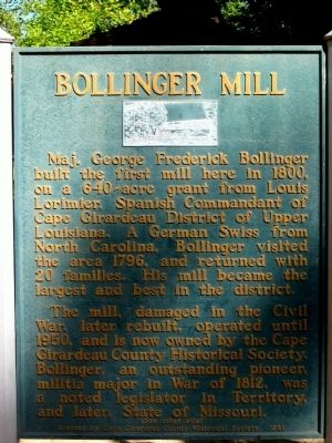
Bollinger Mill
Maj. George Frederick Bollinger built the first mill here in 1800, on a 640-acre grant from Louis Lorimier, Spanish Commandant of Cape Girardeau district of Upper Louisiana. A German Swiss from North Carolina, Bollinger visited this area 1796, and returned with 20 families. His mill became the largest and best in the district.
The mill, damaged in the Civil War, later rebuilt, operated until 1950, and is now owned by the Cape Girardeau County Historical Society. Bollinger, an outstanding pioneer, militia major in the War of 1812, was a noted legislator in the Territory, and later, State of Missouri.
(Back):
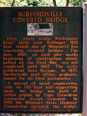
Burfordville Covered Bridge
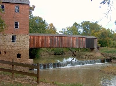
Here, where scenic Whitewater river spills over Bollinger Mill dam, stands on of Missouri's few remaining covered bridges. The date, 1860, on east pier marks beginning of construction which, halted by the Civil War, was not completed until 1867. The early settlement here became, in 1870, Burfordville post office, probably named for its first postmaster.
A marvel of wood engineering, with its 140-foot self-supporting span, the bridge was built of yellow poplar by Cape Girardeau contractor Joseph Lansmon. In 1950 the Missouri State Highway Commission restored the bridge.
Erected 1961 by Cape Girardeau County Historical Society.
Topics and series. This historical marker is listed in these topic lists: Bridges & Viaducts • Industry & Commerce • Settlements & Settlers • War, US Civil. In addition, it is included in the Covered Bridges series list. A significant historical year for this entry is 1800.
Location. 37° 22.058′ N, 89° 48.169′ W. Marker is in Burfordville, Missouri, in Cape Girardeau County. Marker is on County Road 360, 0.1 miles east of State Highway OO, on the right when traveling east. Touch for map. Marker is in this post office area: Burfordville MO 63739, United States of America. Touch for directions.
Other nearby markers. At least 5 other markers are within 11 miles of this marker, measured as the crow flies. "Historical Marker" (approx. 6.3 miles away); Most...are poor and exceedingly dissipated. (approx. 7˝ miles away); They Passed This Way (approx. 7˝ miles away); Marble Hill (approx. 10.1 miles away); Mineral Well (approx. 10.2 miles away).
Credits. This page was last revised on June 16, 2016. It was originally submitted on September 6, 2010, by Allen Gathman of Pocahontas, Missouri. This page has been viewed 1,378 times since then and 21 times this year. Photos: 1, 2, 3, 4. submitted on September 6, 2010, by Allen Gathman of Pocahontas, Missouri. • Craig Swain was the editor who published this page.


