Falmouth in Stafford County, Virginia — The American South (Mid-Atlantic)
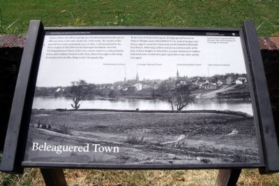
Beleaguered Town
Fredericksburg and Spotsylvania National Military Park
— National Park Service, U.S. Department of the Interior —
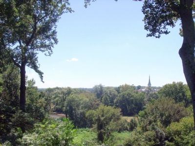
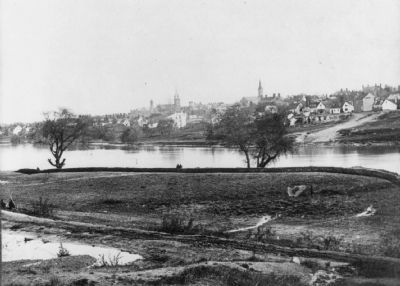
Union soldiers and officers gazing upon Fredericksburg from this spot in 1862 saw many of the same landmarks visible today. The skyline of this peaceful river town, population 5,000 in 1860, is still dominated by the three steeples of City Hall and the Episcopal and Baptist churches. The Rappahannock River, which was a source of power, a transportation artery, and a military obstacle in the 1800s, flows from right to left along its journey from the Blue Ridge to the Chesapeake Bay.
To the west of Fredericksburg lies the high ground known as Marye’s Heights upon which Robert E. Lee posted his gray-clad forces, eager to meet the Union army on the battlefield Burnside had chosen. Following reckless and unsuccessful assaults at the base of those heights on December 13, many hundreds of soldiers from both sides would never gaze upon this or any other earthly vista again.
Erected 2010 by National Park Service, U.S. Department of the Interior.
Topics. This historical marker is listed in these topic lists: War, US Civil • Waterways & Vessels. A significant historical date for this entry is December 13, 1862.
Location. 38° 18.493′ N, 77° 27.367′ W. Marker is in Falmouth, Virginia, in Stafford County. Marker can be reached from Chatham Drive near Chatham Heights Road. Touch for map. Marker is at or near this postal address: 120 Chatham Lane, Fredericksburg VA 22405, United States of America. Touch for directions.
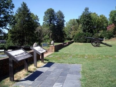
Other nearby markers. At least 8 other markers are within walking distance of this marker. Bombardment (here, next to this marker); Union Soldiers View (here, next to this marker); Fredericksburg Campaign (here, next to this marker); Pontoon Bridges (a few steps from this marker); Between Battles (a few steps from this marker); A Bloody Crossing (a few steps from this marker); A “Picture of Desolation” (within shouting distance of this marker); Sow…Tend…Harvest (about 400 feet away, measured in a direct line). Touch for a list and map of all markers in Falmouth.
More about this marker. On the bottom is a photo of “Fredericksburg as it appeared after the 1862 battle. Many of the buildings seen in the image are still present.”
Related marker. Click here for another marker that is related to this marker. Old Marker At This Location titled "Union Soldiers View".
Also see . . . Fredericksburg & Spotsylvania National Military Park. National Park Service (Submitted on September 7, 2010.)
Credits. This page was last revised on November 14, 2021. It was originally submitted on September 7, 2010, by Bernard Fisher of Richmond, Virginia. This page has been viewed 883 times since then and 18 times this year. Photos: 1, 2, 3, 4. submitted on September 7, 2010, by Bernard Fisher of Richmond, Virginia.


