Near Pemaquid in Lincoln County, Maine — The American Northeast (New England)
Ralph Blaisdell and Family
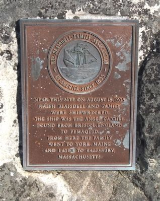
Photographed by Roger W. Sinnott, September 4, 2010
1. Ralph Blaisdell and Family Marker
Near this site on August 15, 1635 Ralph Blaisdell and family were shipwrecked. The ship was the Angel Gabriel bound from Bristol, England to Pemaquid. From here the family went to York, Maine and later to Salisbury, Massachusetts.
Erected by the Blaisdell Family Association, in America since 1635.
Topics. This historical marker is listed in these topic lists: Colonial Era • Disasters • Settlements & Settlers • Waterways & Vessels. A significant historical year for this entry is 1635.
Location. 43° 50.231′ N, 69° 30.38′ W. Marker is near Pemaquid, Maine, in Lincoln County. It can be reached from Bristol Road. Marker is in Pemaquid Lighthouse Park, at the south end of Bristol Road. Touch for map. Marker is in this post office area: Pemaquid ME 04558, United States of America. Touch for directions.

Regionally, this marker is in Midcoast Maine. It is also in the American Northeast, in New England, and on the Eastern Seaboard. Globally, it is in the North Atlantic Region, North America, the Western Hemisphere, the Western World, and the Anglosphere.
Other nearby markers. At least 8 other markers
this page online
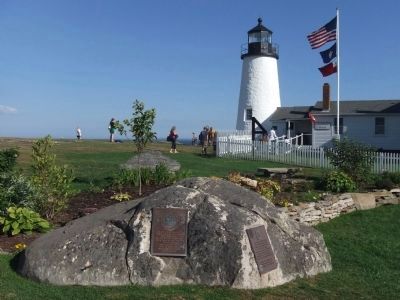
Photographed by Roger W. Sinnott, September 4, 2010
2. Wider View with Pemaquid Lighthouse
Credits. This page was last revised on February 12, 2026. It was originally submitted on September 8, 2010, by Roger W. Sinnott of Norwell, Massachusetts. This page has been viewed 3,435 times since then and 184 times this year. Photos: 1, 2. submitted on September 8, 2010, by Roger W. Sinnott of Norwell, Massachusetts. • Bill Pfingsten was the editor who published this page.
