Panmunjom in Demilitarized Zone, Gyeonggi-do Province, Korea, South — 대한민국 (East Asia, Korean Peninsula)
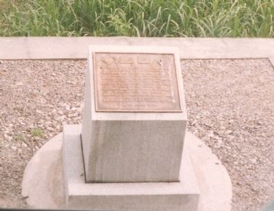
Axe Murder Incident Memorial
{On alternating lines is the translation in Hangul (Korean}.
Topics. This historical marker and memorial is listed in these topic lists: War, Cold • War, Korean. A significant historical year for this entry is 1976.
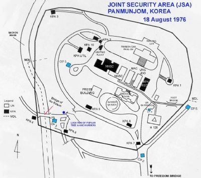
Location. 37° 57.36′ N, 126° 40.355′ E. Marker is in Panmunjom, Gyeonggi-do Province, in Demilitarized Zone. Technically this memorial is located between North and South Korea within the Joint Security Area, jointly administered by both Korean governments, within the Demilitarized Zone. Location is accessed only by escort of military personnel. Touch for map. Marker is in this post office area: Panmunjom, Gyeonggi-do Province 468-1, Korea, South. Touch for directions.
More about this memorial. The memorial is located near the "Bridge of No Return."
Also see . . .
1. Axe Murder Incident. Wikipedia entry detailing the incident. (Submitted on September 11, 2010, by Craig Swain of Leesburg, Virginia.)
2. Memorial Service. Video of a recent memorial service held at the site. (Submitted on September 11, 2010, by Craig Swain of Leesburg, Virginia.)
Photographed By Craig Swain
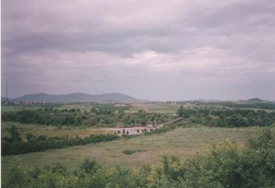
2. Bridge of No Return and Memorial
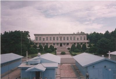
The bridge is known as "The Bridge of No Return" since crossing it indicates a defection to one side or the other of the two Koreas. The location of the poplar tree, and that of the memorial is just visible at the "Y" of the road junction, in front of the guard house. The memorial is on a concrete slab to the right side of the road running toward the bridge.
Credits. This page was last revised on January 18, 2022. It was originally submitted on September 11, 2010, by Craig Swain of Leesburg, Virginia. This page has been viewed 5,797 times since then and 55 times this year. It was the Marker of the Week October 10, 2010. Photos: 1, 2, 3, 4. submitted on September 11, 2010, by Craig Swain of Leesburg, Virginia. 5. submitted on May 13, 2010, by Dodson M. Curry of Birmingham, Alabama.
Editor’s want-list for this marker. Clearer photo of monument. • Can you help?
