Northport in Tuscaloosa County, Alabama — The American South (East South Central)
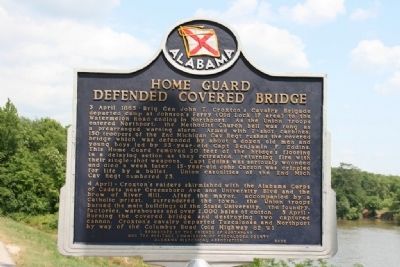
Home Guard Defended Covered Bridge
⎯⎯⎯
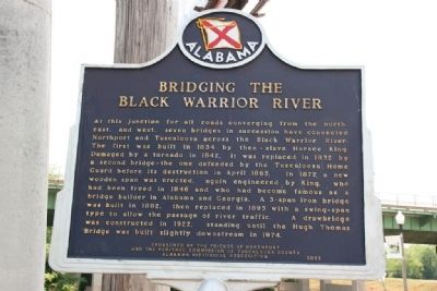
Bridging The Black Warrior River
Photographed by Tim & Renda Carr, May 13, 2010
1. Side A: Home Guard Defended Covered Bridge
4 April - Croxton’s raiders skirmished with the Alabama Corps of Cadets near Greensboro Ave and University Blvd and the brow of River Hill. After the mayor, accompanied by a Catholic priest, surrendered the town, the Union troops burned the main buildings of the State University, the foundry, factories, warehouses and
this page online
(Reverse):
Erected 2002 by Alabama Historical Association, Sponsored by the Friends of Northport and the Heritage Commission
Photographed by Tim & Renda Carr, May 13, 2010
2. Side B: Bridging The Black Warrior River
Topics and series. This historical marker is listed in these topic lists: Bridges & Viaducts • War, US Civil. In addition, it is included in the Alabama Historical Association, and the Covered Bridges series lists. A significant historical date for this entry is April 3, 1865.
Location. 33° 12.924′ N, 87° 34.409′ W. Marker is in Northport, Alabama, in Tuscaloosa County. It is on Bridge Avenue when traveling south. Marker is located at the end of Bridge Avenue on the bank of the Black Warrior River. Touch for map. Marker is at or near this postal address: 1 Bridge Avenue, Northport AL 35476, United States of America. Touch for directions.

Regionally, this marker is in the American South and specifically in the Deep South. Globally, it is in North America, a Gulf of Mexico state, the Western Hemisphere, the Western World, and the Anglosphere. Historically, it finds itself in what was once the territory of the Mississippian Culture, one of the Confederate States of America, and the Antebellum South.
Other nearby markers. At least 8 other markers are within walking distance of this marker: Horace King (about
Photographed by Tim & Renda Carr, May 13, 2010
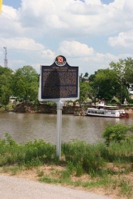
3. Home Guard Defended Covered Bridge / Bridging The Black Warrior River Marker
Photographed by Tim & Renda Carr, May 13, 2010
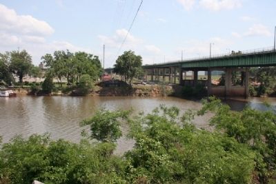
4. The Hugh Thomas Bridge crossing the Black Warrior River.
On the opposite side of the river under the power lines stands the original approach of the past bridges that spanned the river at this location.
Credits. This page was last revised on June 16, 2016. It was originally submitted on September 13, 2010, by Timothy Carr of Birmingham, Alabama. This page has been viewed 3,096 times since then and 208 times this year. Photos: 1, 2, 3, 4. submitted on September 13, 2010, by Timothy Carr of Birmingham, Alabama. • Craig Swain was the editor who published this page.
