Near Garfield in Benton County, Arkansas — The American South (West South Central)
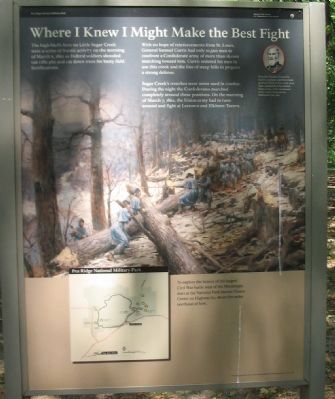
Where I Knew I Might Make the Best Fight
Pea Ridge National Military Park
— National Park Service, U.S. Department of the Interior —
The high bluffs here on Little Sugar Creek were a scene of frantic activity on the morning of March 6, 1862 as Federal soldiers shoveled out rifle pits and cut down trees for hasty field fortifications.
With no hope of reinforcements from St. Louis, General Samuel Curtis had only 10,500 men to confront a Confederate army of more than 16,000 marching toward him. Curtis ordered his men to use this creek and the line of steep hills to prepare a strong defense.
Sugar Creek's trenches were never used in combat. During the night the Confederates marched completely around these positions. On the morning of March 7, 1862, the Union army had to turn around and fight at Leetown and Elkhorn Tavern.
Brigadier General Samuel R. Curtis, a 57-year-old West Point graduate born in New York, first took command of the United States Army of the Southwest in St. Louis, Missouri on Christmas Day 1861.
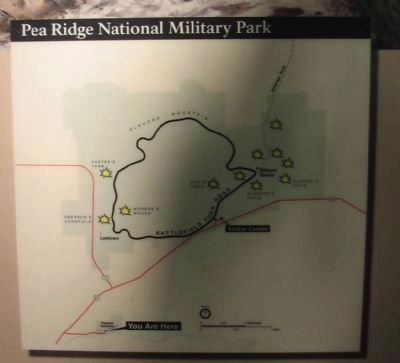
To explore the history of the largest Civil War battle west of the Mississippi, start at the National Park Service Visitor Center on Highway 62, about five miles northeast of here.
Erected by National Park Service, U.S. Department of the Interior.
Topics. This historical marker is listed in this topic list: War, US Civil. A significant historical date for this entry is March 6, 1854.
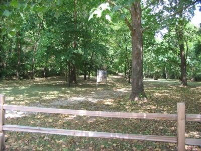
Location. 36° 25.212′ N, 94° 3.351′ W. Marker is near Garfield, Arkansas, in Benton County. Marker is on Sugar Creek Road (County Road 44), on the right when traveling east. Located at stop 11, Little Sugar Creek Trenches, on the driving tour of pea Ridge National Military Park. The stop is reached from US 62, about 2 1/2 miles southwest of the park visitor center entrance. Touch for map. Marker is in this post office area: Garfield AR 72732, United States of America. Touch for directions.
Other nearby markers. At least 8 other markers are within 2 miles of this marker, measured as the crow flies. Dunagin's Farm (approx. 0.6 miles away); Leetown (approx. 1.4 miles away); A Village Full of Wounded Men (approx. 1˝ miles away); Sesquicentennial Trail of the Centuries (approx. 1.6 miles away); A Fierce Tangle in Morgan's Woods (approx. 1.7 miles away); Stand to Your Posts! (approx. 1.7 miles away); A Crisis in Command (approx. 1.7 miles away); Save the Cannon! (approx. 1.7 miles away). Touch for a list and map of all markers in Garfield.
Also see . . .
1. Pea Ridge National Military Park. National Park Service website entry (Submitted on September 13, 2010, by Craig Swain of Leesburg, Virginia.)
2. Pea Ridge (Elkhorn Tavern). American Battlefield Trust website entry (Submitted on May 8, 2021, by Larry Gertner of New York, New York.)

Photographed By Craig Swain, August 30, 2010
3. Federal Trenches
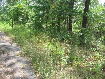
At the top of the bluffs behind the marker, and a walk up a steep trail, are vestiges of the earthworks built by the Federals during the first week of March 1862. The defenses were never tested, as the Confederates opted to march around the Federals and attack from the north around Elkhorn Mountain.
Credits. This page was last revised on July 10, 2022. It was originally submitted on September 13, 2010, by Craig Swain of Leesburg, Virginia. This page has been viewed 1,348 times since then and 47 times this year. Photos: 1, 2, 3, 4. submitted on September 13, 2010, by Craig Swain of Leesburg, Virginia.


