Milledgeville in Baldwin County, Georgia — The American South (South Atlantic)
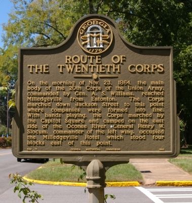
Route of the Twentieth Corps
Erected 1956 by Georgia Historical Commission. (Marker Number 005-11.)
Topics and series. This historical marker is listed in this topic list: War, US Civil. In addition, it is included in the Georgia Historical Society, and the Sherman’s March to the Sea series lists. A significant historical date for this entry is October 23, 1841.
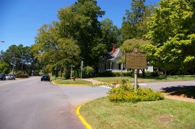
Location. 33° 4.699′ N, 83° 14.104′ W. Marker is in Milledgeville, Georgia, in Baldwin County. Marker is at the intersection of West Greene Street and South Jackson Street, on the left when traveling east on West Greene Street. Touch for map. Marker is in this post office area: Milledgeville GA 31061, United States of America. Touch for directions.
Other nearby markers. At least 8 other markers are within walking distance of this marker. Brown-Stetson-Sanford House (about 500 feet away, measured in a direct line); Old Governor’s Mansion (approx. 0.2 miles away); a different marker also named The Old Governor's Mansion (approx. 0.2 miles away); Lafayette's Tour (approx. ¼ mile away); State College (approx. ¼ mile away); Tomlinson Fort House (approx. 0.3 miles away); Georgia State Penitentiary (approx. 0.3 miles away); Dr. Charles Holmes Herty (approx. 0.3 miles away). Touch for a list and map of all markers in Milledgeville.
Credits. This page was last revised on June 16, 2016. It was originally submitted on September 14, 2010, by David Seibert of Sandy Springs, Georgia. This page has been viewed 1,238 times since then and 25 times this year. Photos: 1, 2. submitted on September 14, 2010, by David Seibert of Sandy Springs, Georgia. • Craig Swain was the editor who published this page.

