Locust Grove in Orange County, Virginia — The American South (Mid-Atlantic)
Germanna Ford
Grant Takes Command
— Lee Vs. Grant - The 1864 Campaign —
Inscription.
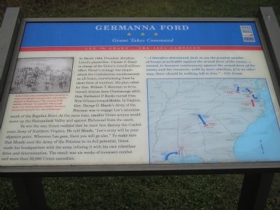
In March 1864, President Abraham Lincoln placed Gen. Ulysses S. Grant in charge of the Union’s overall military effort. Grant’s strategy was simple: attack the Confederates simultaneously on all fronts, overwhelming them by sheer force of numbers. His plan called for Gen. William T. Sherman to drive towards Atlanta from Chattanooga while Gen. Nathaniel P. Banks moved from New Orleans towards Mobile. In Virginia, Gen. George G. Meade’s Army of the Potomac was to engage Lee’s attention south of the Rapidan River. At the same time, smaller Union armies would move up the Shenandoah Valley and against Richmond from the south.
To win the war, Grant realized that he must first destroy the Confederate Army of Northern Virginia. He told Meade, “Lee’s army will be your objective point. Whereever Lee goes, there you will go also.” To make sure that Meade used the Army of the Potomac to its full potential, Grant made his headquarters with the army infusing it with his own relentless drive and determination. The result was six weeks of incessant combat and more than 50,000 Union casualties.
“...I therefore determined, first, to use the greatest number of troops practicable against the armed force of the enemy...; second, to hammer continuously against the armed force of the enemy and his resources, until by mere attrition, if in no other way, there should be nothing left of him.”—U.S. Grant
Erected by Virginia Civil War Trails.
Topics and series. This historical marker is listed in this topic list: War, US Civil. In addition, it is included in the Former U.S. Presidents: #16 Abraham Lincoln, the Former U.S. Presidents: #18 Ulysses S. Grant, and the Virginia Civil War Trails series lists. A significant historical month for this entry is March 1864.
Location. This marker has been replaced by another marker nearby. It was located near 38° 22.632′ N, 77° 46.91′ W. Marker was in Locust Grove, Virginia, in Orange County. Marker was at the intersection of Germanna Highway (Virginia Route 3) and the Germanna Community College Entrance (Virginia Route 375), on the right when traveling south on Germanna Highway. Just north of Route 760. Touch for map. Marker was at or near this postal address: 2062 Germanna Hwy, Locust Grove VA 22508, United States of America. Touch for directions.
Other nearby markers. At least 8 other markers are within walking distance of this location. A different marker also named Germanna Ford (within shouting distance of this marker); Germanna (within shouting distance of this marker); a different marker also named Germanna Ford (about 300 feet away, measured in a direct line); Grant Takes Command (about 300 feet away); Fort Germanna (about 400 feet away); Alexander Spotswood's Enchanted Castle (about 400 feet away); Fort Germanna Visitor Center (about 400 feet away); Hans Conrad Amberger (about 500 feet away). Touch for a list and map of all markers in Locust Grove.
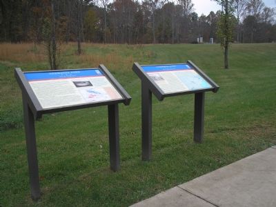
Regarding Germanna Ford. On the upper left is a wartime sketch showing As the Union army crossed the river, Grant sat on a log overlooking Germanna Ford and penned a dispatch to Washington, "The crossing of the Rapidan effected," he reported. "Forty-eight hours now will demonstrate whether the enemy intends giving battle this side of Richmond." On the right a strategic map of the southeastern United States illustrates the situation described in the text.
Related marker. Click here for another marker that is related to this marker. This marker has been replaced with the linked marker.
Also see . . . Civil War Trails – Lee vs. Grant: The 1864 Overland Campaign Tour. (Submitted on March 6, 2008, by Bill Coughlin of Woodland Park, New Jersey.)
Credits. This page was last revised on April 19, 2021. It was originally submitted on November 17, 2007, by Bill Coughlin of Woodland Park, New Jersey. This page has been viewed 1,809 times since then and 13 times this year. Photos: 1, 2. submitted on November 17, 2007, by Bill Coughlin of Woodland Park, New Jersey. • J. J. Prats was the editor who published this page.

