Pineville in Bell County, Kentucky — The American South (East South Central)
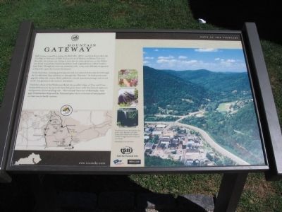
Mountain Gateway
In the early days, hunting parties penetrated into eastern Kentucky first through the Cumberland Gap and then on through the "Narrows." As both prominent gaps lie within the county, Bell cradled the critical mountain passage and served as the very gateway to the western movement.
Until the advent of the Wilderness Road, the parallel ridges of Pine and Cumberland Mountains lay upon the land like great stone walls that barred explorers and pioneers from traveling west. The eventual discovery of Kentucky's twin gaps (Cumberland Gap and the Narrows) gave rise to a torrent of immigrants on their way to build a nation.
Pine Mountain became Kentucky's first state park in 1924, Regarded as one of the country's finest natural resorts, the park is noted for it's rugged mountain terrain and scenic beauty.
Topics. This historical marker is listed in these topic lists: Natural Features • Settlements & Settlers. A significant historical month for this entry is February 1867.
Location. 36° 45.676′ N, 83° 41.736′ W. Marker is in Pineville, Kentucky, in Bell County. Marker is at the intersection of Kentucky Avenue and Pine Street (Kentucky Highway 66), on the right when traveling east on Kentucky Avenue. Located in front of the Bell County courthouse. Touch for map. Marker is in this post office area: Pineville KY 40977, United States of America. Touch for directions.
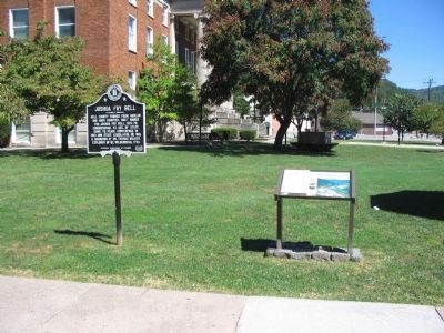
Other nearby markers. At least 8 other markers are within 2 miles of this marker, measured as the crow flies. Bell County War Dead Memorial (here, next to this marker); Joshua Fry Bell (here, next to this marker); Daniel Boone's Trail (within shouting distance of this marker); Cumberland Ford (approx. 0.2 miles away); The Wilderness Road (approx. 0.4 miles away); Chained Rock (approx. 0.6 miles away); Wallsend Mine (approx. 0.6 miles away); Wilderness Road Cemetery (approx. 1.2 miles away). Touch for a list and map of all markers in Pineville.
Credits. This page was last revised on June 16, 2016. It was originally submitted on September 18, 2010, by Craig Swain of Leesburg, Virginia. This page has been viewed 885 times since then and 22 times this year. Photos: 1, 2, 3. submitted on September 18, 2010, by Craig Swain of Leesburg, Virginia.


