Near Spotsylvania Courthouse in Spotsylvania County, Virginia — The American South (Mid-Atlantic)
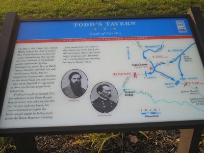
Todd’s Tavern
Clash of Cavalry
— Lee vs. Grant - The 1864 Campaign —
Finding himself outflanked, Fitz Lee withdrew to the Piney Branch Road junction, two miles to your left. For the next eighteen hours, his troops continued to hinder the Union army’s march by felling trees across the Brock Road and shooting Union cavalrymen who tried to clear them out of the way. Lee’s stiff resistance slowed the Union army’s progress and ultimately led to the Confederates winning the race to Spotsylvania.
Erected by Civil War Trails.
Topics and series. This historical marker is listed in this topic list: War, US Civil. In addition, it is included in the Virginia Civil War Trails series list. A significant historical month for this entry is May 1864.
Location. 38° 14.849′ N, 77° 40.119′ W. Marker is near Spotsylvania Courthouse, Virginia, in Spotsylvania County. Marker is at the intersection of Brock Road (County Route 613) and Catharpin Road (County Route 612), on the right when traveling south on Brock Road. Touch for map. Marker is at or near this postal address: 9626 Brock Rd, Spotsylvania VA 22553, United States of America. Touch for directions.
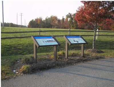
Other nearby markers. At least 8 other markers are within 2 miles of this marker, measured as the crow flies. A different marker also named Todd’s Tavern (here, next to this marker); a different marker also named Todd’s Tavern (here, next to this marker); Lafayette at Corbin’s Bridge (a few steps from this marker); Chancellorsville Campaign (approx. 1.2 miles away); a different marker also named Chancellorsville Campaign (approx. 1.4 miles away); a different marker also named Chancellorsville Campaign (approx. 1.4 miles away); a different marker also named Chancellorsville Campaign (approx. 1.7 miles away); The Piney Branch School (approx. 1.8 miles away). Touch for a list and map of all markers in Spotsylvania Courthouse.
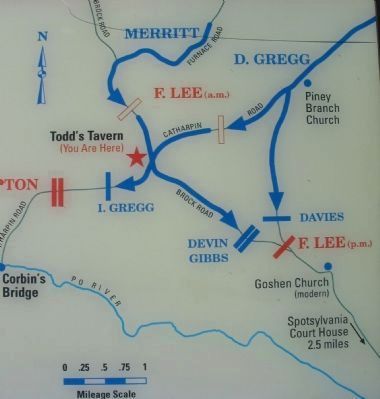
More about this marker. The marker displays portraits of Fitzhugh Lee and Philip Sheridan. On the right is a map showing the major activities of the Todd's Tavern battle.
Also see . . .
1. Battle of Todd's Tavern. National Park Service summary of the battle and driving tour. (Submitted on February 17, 2008, by Craig Swain of Leesburg, Virginia.)
2. Civil War Trails – Lee vs. Grant: The 1864 Overland Campaign Tour. (Submitted on March 6, 2008, by Bill Coughlin of Woodland Park, New Jersey.)
Credits. This page was last revised on July 9, 2021. It was originally submitted on November 17, 2007, by Bill Coughlin of Woodland Park, New Jersey. This page has been viewed 2,327 times since then and 14 times this year. Photos: 1. submitted on November 17, 2007, by Bill Coughlin of Woodland Park, New Jersey. 2. submitted on February 17, 2008, by Craig Swain of Leesburg, Virginia. 3. submitted on November 17, 2007, by Bill Coughlin of Woodland Park, New Jersey. 4. submitted on February 17, 2008, by Craig Swain of Leesburg, Virginia. • J. J. Prats was the editor who published this page.


