Downtown Springfield in Greene County, Missouri — The American Midwest (Upper Plains)
Battle of Springfield
Inscription.
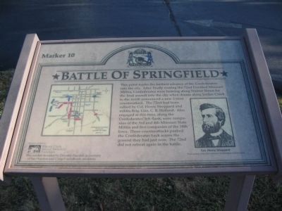
This point marks the farthest advance of the Confederates into the city. After finally routing the 72nd Enrolled Missouri Militia, Confederates were forming along Walnut Street for the final assault into the city when drums along Jordan Creek to the north announced a new Union counterattack. The 72nd had been rallied by Col. Henry Sheppard and militia Brig. Gen. C.B. Holland. Also engaged at this time, along the Confederates' left flank, were companies of the 3rd and 4th Missouri State Militia and five companies of the 18th Iowa. These counterattacks pushed the Confederates back across the ground they had just won. The 72nd did not retreat again in the battle.
Erected by Wilson's Creek National Battlefield Foundation (this marker donated by Dorothy Haydon in memory of her Haydon and Craig Confederate ancestors). (Marker Number 10.)
Topics and series. This historical marker is listed in this topic list: War, US Civil. In addition, it is included in the Missouri, Battle of Springfield series list.
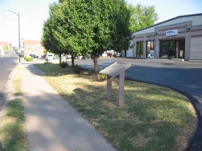
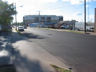
Location. 37° 12.426′ N, 93° 17.756′ W. Marker is in Springfield, Missouri, in Greene County. It is in Downtown Springfield. Marker is at the intersection of West Walnut Street and South Market Street , on the right when traveling east on West Walnut Street. Touch for map. Marker is at or near this postal address: 502 West Walnut Street, Springfield MO 65806, United States of America. Touch for directions.
Other nearby markers. At least 8 other markers are within walking distance of this marker. A different marker also named Battle of Springfield (approx. 0.2 miles away); Wild Bill's Shootout (approx. 0.2 miles away); 1971 Tumbler (approx. ¼ mile away); a different marker also named Battle of Springfield (approx. ¼ mile away); History of Springfield Public Square (approx. ¼ mile away); Three Black Men Lynched (approx. ¼ mile away); a different marker also named Battle of Springfield (approx. ¼ mile away); a different marker also named Battle of Springfield (approx. ¼ mile away). Touch for a list and map of all markers in Springfield.
Also see . . .
1. Battle of Springfield. Brief summary of the battle. (Submitted on September 19, 2010, by Craig Swain of Leesburg, Virginia.)
2. Second Battle of Springfield. Wikipedia entry. (Submitted on September 19, 2010, by Craig Swain of Leesburg, Virginia.)
Credits. This page was last revised on May 28, 2023. It was originally submitted on September 19, 2010, by Craig Swain of Leesburg, Virginia. This page has been viewed 1,945 times since then and 30 times this year. Photos: 1, 2, 3. submitted on September 19, 2010, by Craig Swain of Leesburg, Virginia.


